The Best Moderate Hikes in Western North Carolina
This page includes all Moderate hikes.
Each hike has its own printable guide page with all the information and links, including (where available):
- directions to the starting point
- length
- difficulty
- elevation change
- an interactive topo map
- photos from along the way
- a detailed description and trail directions, and
- a place to leave comments about your experiences
Graveyard Fields


- A unique loop trail winds through this high-elevation, flat valley. Two spurs lead to some of the most photographed and …
- 3.2 mi, Hilly
- Tread Condition: Some Obstacles
Mount Pisgah
- A classic Blue Ridge Parkway hike, this trail continues onto National Forest land to climb to the summit of one …
- 3 mi, Climbs Moderately
- Tread Condition: Moderately Rough
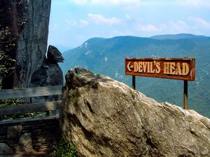
Skyline-Cliff Trail
- **Note:** This hike is currently closed, and according to the recently released Master Plan for Chimney Rock Park, it will …
- 1.5 mi, Climbs Moderately
- Tread Condition: Some Obstacles
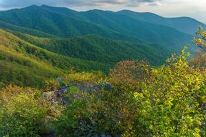
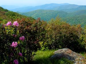
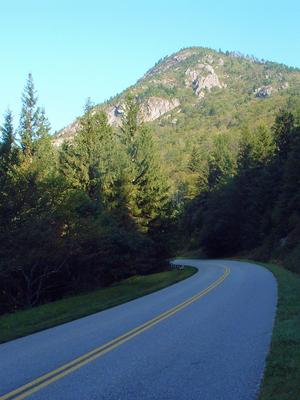
Craggy Pinnacle
- This popular trail climbs a short distance from a Blue Ridge Parkway overlook to a high, rocky peak with commanding …
- 1.4 mi, Climbs Moderately
- Tread Condition: Some Obstacles
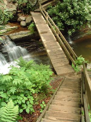
Cove Creek and Caney Bottom
- Beautiful Pisgah scenery abounds on this classic loop hike, which travels past several nice waterfalls, through some flats above the …
- 4.2 mi, Climbs Moderately
- Tread Condition: Moderately Rough
Skinny Dip Falls
- This moderate, short hike takes you to an appealing waterfall and swimming hole on the Yellowstone Prong of the Big …
- 0.8 mi, Climbs Moderately
- Tread Condition: Moderately Rough
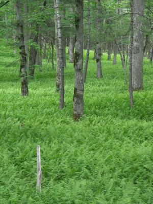
Pink Beds Loop
- This relatively flat loop hike - which features a shortcut option - is all about water. You'll see rare mountain …
- 5.1 mi, Few Hills
- Tread Condition: Some Obstacles
Snowball
- Not to be confused with Hawksbill Mountain in the Linville Gorge, Hawkbill Rock is an outcrop along the ridge between …
- 2.75 mi, Hilly
- Tread Condition: Moderately Rough
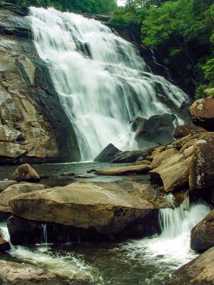
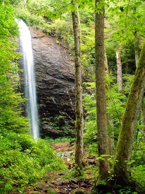
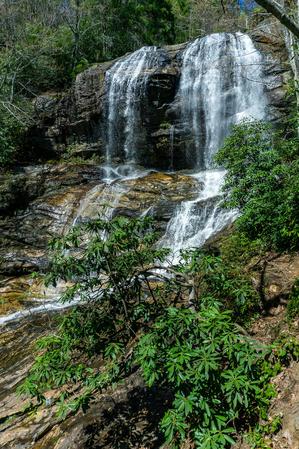
Rainbow Falls
- Rainbow Falls is one of the biggest and most scenic falls in the region. An excellent 3-mile round trip hike …
- 3.0 - 4.0 mi, Hilly
- Tread Condition: Moderately Rough
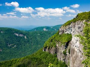
Whiteside Mountain
- This excellent loop, designated a National Recreation Trail, climbs to the top of Whiteside Mountain, with its spectacular 700 ft …
- 2.5 mi, Hilly
- Tread Condition: Moderately Rough
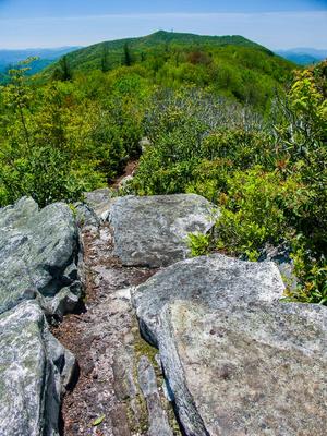
Sam Knob
- At the top of an imposing mountain peak located at the edge of the Shining Rock Wilderness, spectacular views await! …
- 2.2 mi, Climbs Moderately
- Tread Condition: Moderately Rough
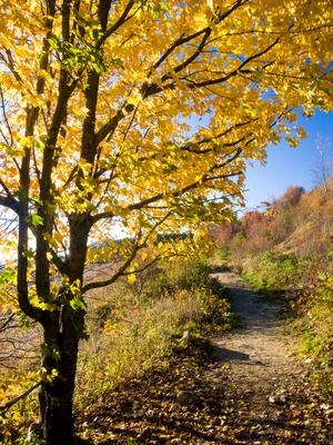
Summit and Rhododendron Trail Loop
- This mountaintop self-guiding nature trail, which is also a Kids In Parks TRACK trail, is a gem in North Carolina's …
- 1.5 mi, Few Hills
- Tread Condition: Some Obstacles
Firescald Knob
- Comprising one of the easier destination hikes in North Carolina's Shelton Laurel area of Pisgah National Forest (and winding into …
- 4.5 mi, Hilly
- Tread Condition: Moderately Rough
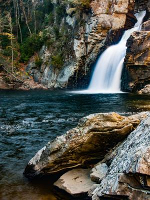
Linville Falls - Plunge Basin
- A short but rugged trail takes you to the base of this impressive falls; the roughness is mitigated somewhat since …
- 1.4 - 1.8 mi, Climbs Steeply
- Tread Condition: Moderately Rough
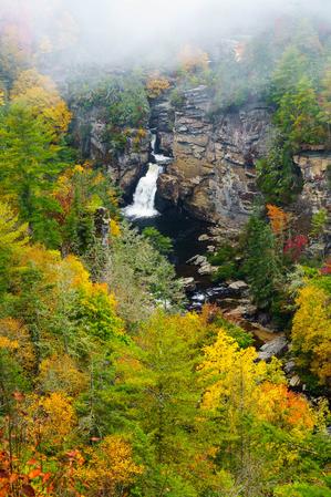
Linville Falls - Erwin's View
- Linville Falls has two main trails: Erwin's view and Plunge Basin. Erwin's view is the easier of the two, and …
- 1.5 mi, Few Hills
- Tread Condition: Some Obstacles
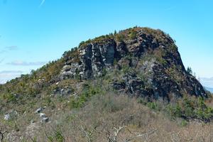
Table Rock
- This trail climbs steeply to the top of a knife ridge, which from afar looks flat, giving the mountain its …
- 2.0 mi, Climbs Moderately
- Tread Condition: Moderately Rough
Douglas Falls (Lower Approach)
- This spectacular, 70 ft. falls is located in an old-growth forest. The lower approach to the falls is a walk …
- 1 mi, Climbs Gently
- Tread Condition: Moderately Rough
Devil's Courthouse
- This hike takes you to the summit of Devil's Courthouse, a high-elevation rocky summit with a fantastic cliff-top overlook. But …
- 4.3 mi, Climbs Moderately
- Tread Condition: Moderately Rough
Flat Laurel Creek
- This loop takes you around the headwaters basin of Flat Laurel Creek, which starts in a unique, high-elevation valley surrounded …
- 2.5 mi, Climbs Gently
- Tread Condition: Moderately Rough
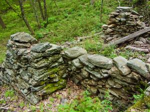
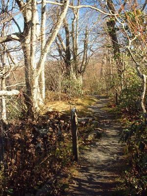
Rattlesnake Lodge
- This pleasant hike takes you to the ruins of a historic private lodge along a section of the Mountains to …
- 2.8 mi, Climbs Moderately
- Tread Condition: Some Obstacles
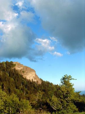
Potato Knob Fields
- A well-known area landmark, Potato Knob is a rocky, prominent peak visible from the Blue Ridge Parkway, many points in …
- 2 mi, Climbs Moderately
- Tread Condition: Moderately Rough
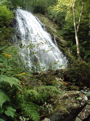
Crabtree Falls
- This popular, short loop descends on a moderate path to a majestic 70 ft waterfall, which is widely touted as …
- 3 mi, Hilly
- Tread Condition: Some Obstacles
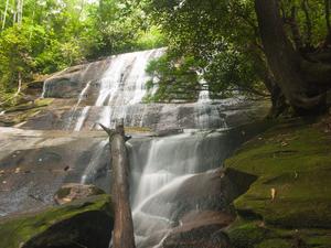
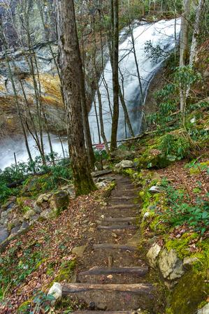
Glen Falls
- This trail takes the hiker through a pleasant forest of hardwoods and pines to one of the spectacular waterfalls of …
- 1.1 mi, Climbs Steeply
- Tread Condition: Moderately Rough
Tuckasegee High Falls
- There's a lot of neat things to see packed into this relatively short, 0.7 mi path. Even if the trail …
- 1.4 mi, Climbs Steeply
- Tread Condition: Some Obstacles
