Tuckasegee High Falls
At A Glance
TODO: #32 Boilerplate

1.4 mi round-trip
Difficulty Rating: 2.68 ![]()
Climb: Climbs Steeply ![]()
Tread Condition: Some Obstacles ![]()
Highest Elevation: 3510 ft
Climb Total: 650 ft
Configuration: Out-and-back
Starting Point: Pines Recreation Area
For years, this waterfall was a thing of legend, but nearly inaccessible to the public, for those unwilling to trespass. But as part of re-licensing its dams with the government in the 2010's for the next 30 years, Duke Energy agreed to build a trail to the falls for hiker and kayaker access. This was truly a waterfall enthusiast's dream come true!
Water Releases
The falls is not flowing full-force all the time. Duke lets some water over the falls on a regular basis several days per year, primarily for whitewater kayaking in the stretch of river downstream. But water is also released during periods of heavy rain or when the lake is lowered for maintenance.
To see a schedule of water releases, visit Duke Energy's scheduled releases page. Select Nantahala from the drop-down, and look under West Fork to see when the water is being released. A link to a calendar for upcoming release days is on the right side of the page.
Also see American Whitewater's page on the river. Releases are sometimes rescheduled for various reasons, so check as the date approaches to make sure it's still on.
On The Trail
Now, the trail itself. Assuming you're here on a release day or just hiking when the water is lower, the trail starts at the parking area away from the lake. It begins as a gated road leading down below part of the dam. It winds downhill on a graveled path to a hairpin turn near a drainage basin, then turns right at a sign. From there the trail becomes much steeper and descends sets of log steps toward the river, which it begins following downstream.
Upstream from this point is Onion Falls, a man-made cataract that constitutes the dam's spillway. You aren't allowed to leave the trail to see it, however, and though it's high and interesting-looking, it's man-made and has that non-natural look to it. I recommend keeping on toward High Falls.
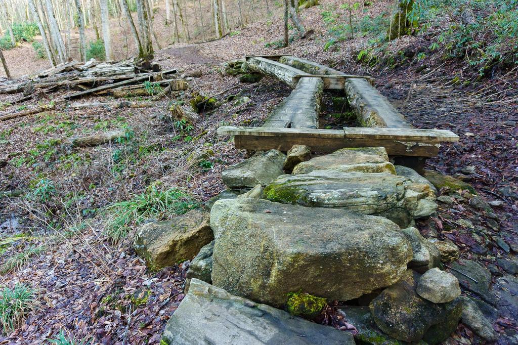
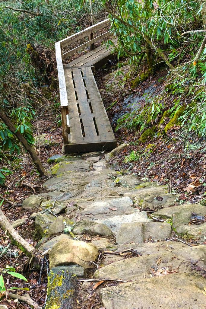
The trail will cross a couple of unique, small bridges and then descend steeply on rock steps. Only short stretches are actual dirt trail. You'll see how much work was required to build this trail - hundreds of massive logs and stones (sourced from on-site) were put into place to keep hikers safely on the path. It's truly a remarkable work of trailbuilding expertise.
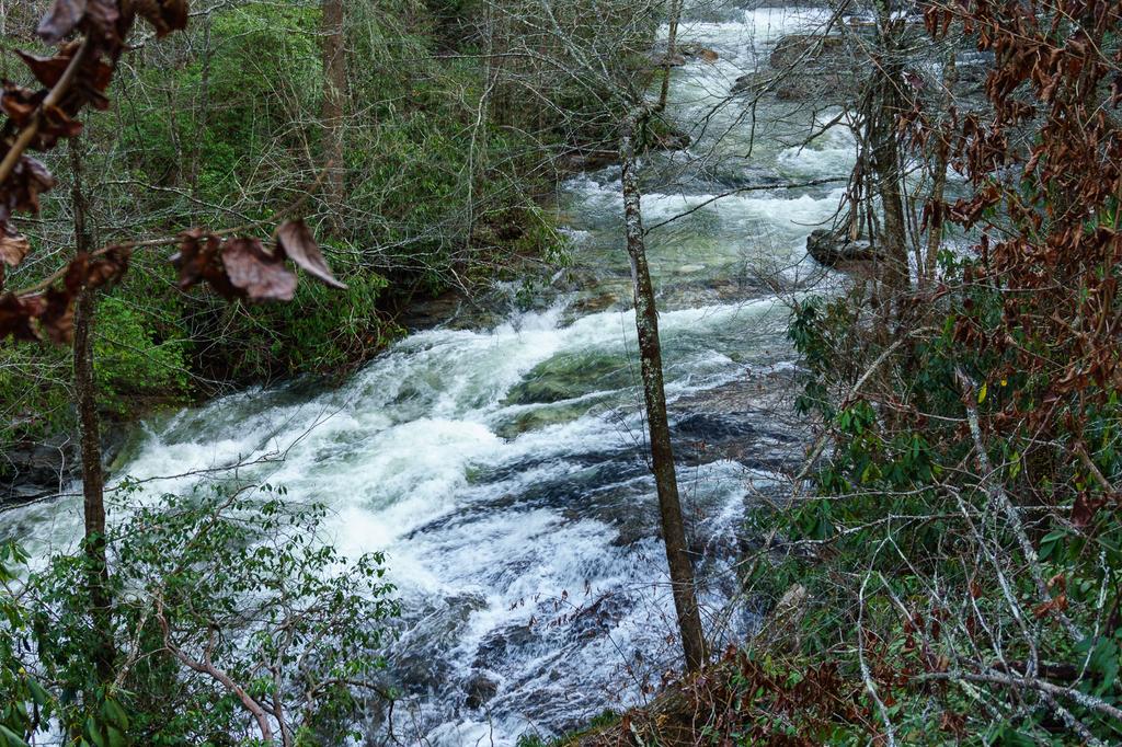
The trail passes by a distinct, separate upper waterfall, called First Falls by the whitewater community. Now - here's the thing about First Falls. Frankly, it's a heckuva waterfall on release days, dropping about 60 ft against a massive rock face before veering river-left into a deep pool in a massive plume of spray, with picturesque rapids downstream.
What's just amazing is that a waterfall this size barely even gets mentioned as a footnote most places (though to be fair - most of the time, it is nearly dry). Thousands of people literally hike right past it, yet you can barely even find a photo of it. So here's one for you:

If 150-ft High Falls wasn't just downstream, First Falls would be a well-known destination in its own right!
But given the bigger waterfall downstream and the extremely rugged area in which it is situated, it's not exactly safe to try to get a closer look. And most people just want to get on to the main event already, so barely give First Falls a passing glance. So enjoy what you can see from the trail - the view is decent during the winter when the leaves are off the trees.
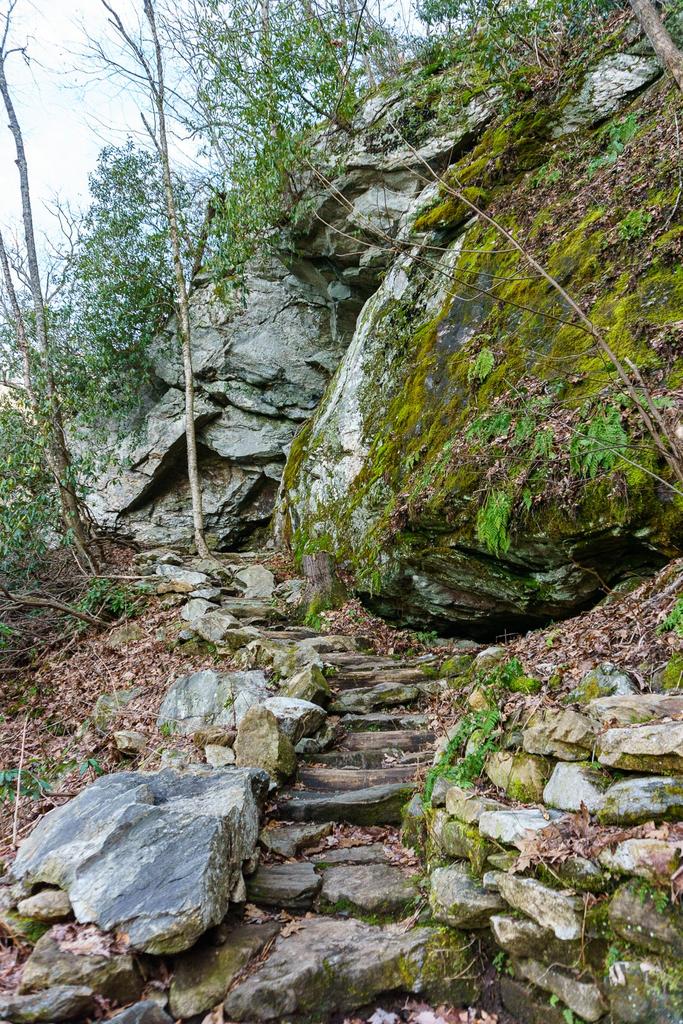
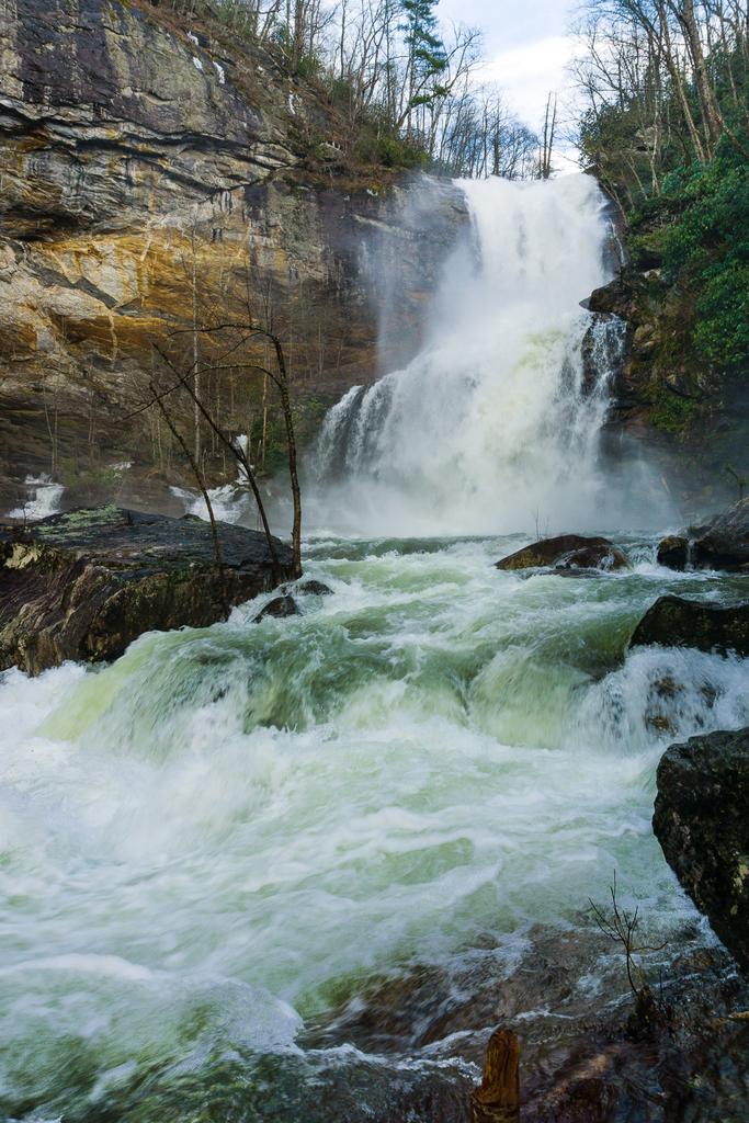
Past First Falls, the trail passes under a neat overhanging cliff as you go past the brink of High Falls. The trail then descends on rock steps through a mossy forest on a series of masterfully-constructed switchbacks, with rock walls and artfully chosen anchors at each segment of trail. You get to hike this beautiful (if short) stretch of trail, right beside the roaring upper part of High Falls (or the quieter version on non-release days). Either way, it's truly amazing.
The trail finally descends enough to reach the boater put-in at the base of High Falls. There's not a ton of room for moving around or hanging out on this side of the river, but there is adequate space to take in the view. And what a view it is! The upper, smooth portion of the falls is still visible, but now you get to see the lower portion, which often splits into two or three distinct streams over the craggy ledge below the smooth cliff face above.
If the water is flowing, the last set of steps will be soaked from the spray, and completely iced over during freezing weather. You will get wet on this one.
Some final words of caution:
- Water could potentially be released from the dam at any time, without advance notice, even when it is not scheduled. So be very careful if visiting on non-release days and always expect the possibility of rapidly rising water levels.
- All the property downstream of the kayaker put-in is private property, so keep off.
- The put-in is not the optimal viewing area for the waterfall when the water is high (it's right in the spray zone so you'll get soaked), but crossing the river just isn't a viable option. So don't get swept away trying to get a better view.
- Don't arrive in the morning before a release starts and get trapped on the other side of the river, either. Once it's flowing, it rages, and there's just no safe way across.
- The first water tends to carry with it whatever fell into the riverbed since the last release, so watch out - it could carry mud, leaves, sticks, logs, etc. until it clears up.
For the full experience of the natural force of this waterfall, visit when the water is high or watch a release. For a chance at close-up exploration (and perhaps better conditions for photography), visit when the water is low.
Once you've taken in the view, return to the parking area via the same path. Remember, the hike out is all uphill, so allow yourself adequate time and energy.
Shortcode: Video Here

This site is part of the
WNCOutdoors.info network
Western North Carolina
Hiking | Mountain Biking | Waterfalls
Advertising Information | Contact Us
©1996-2025 CC-BY-SA | Privacy Policy