Potato Knob Fields
At A Glance
TODO: #32 Boilerplate

2 mi round-trip
Difficulty Rating: 2.94 ![]()
Climb: Climbs Moderately ![]()
Tread Condition: Moderately Rough ![]()
Highest Elevation: 5720 ft
Climb Total: 350 ft
Configuration: Out-and-back
Starting Point: Parking Area on NC 128, just off the Blue Ridge Parkway
Trails Used: TODO dynamic list Mountains to Sea
Start the hike by ascending the stairs across the road from the parking pulloff. You will see the sign for the Mountains to Sea Trail, and this trail follows white circular blazes. You will immediately pass through a staggered fence designed to keep large animals (e.g., horses) off the trail. The trail is well-blazed, and it is not difficult to stay on course.
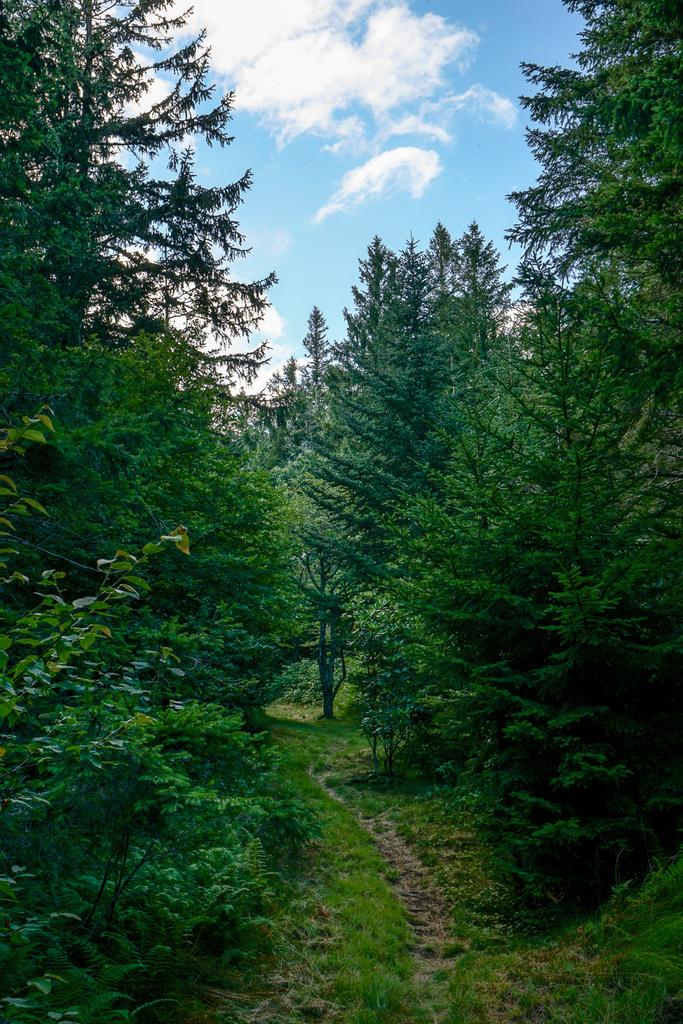
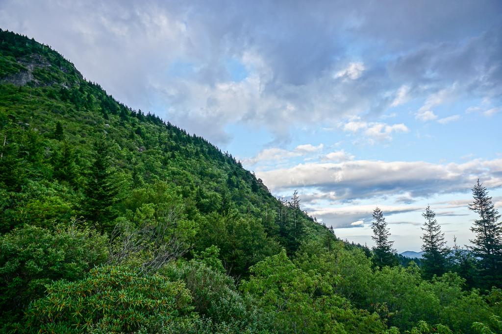
The trail turns back to the left (south) in a grassy area, then ascends gently through a grove of spruce to reach the ridgeline. From the very start, you will notice how well this trail was built. Its design sheds water at all possible locations, and the trailbed is "outsloped" - meaning water runs across and off the edge of the trail rather than down the length of the trail. This means the trail is not eroded, an unusual state for trails at this elevation to be in, making the walk that much more pleasant. The entire trail up to the meadows is similarly built - in fact, most new sections of the Mountains to Sea Trail are this way.
As you approach the ridge, you'll notice the tall, straight spruce trees, whose dark appearance from afar in comparison to other trees give the Black Mountains their name. However, many of the spruces on this section are not the area's native Red Spruce which once grew here - they are Norway Spruce, imported from Europe and planted after the Black Mountains were logged in the early 20th century.
Valuable for its soft, resilient, slightly reddish wood, the Red Spruce were logged extensively during World War II and used for airplane propellers, leaving the mountains denuded. When it later became clear that the widespread logging was destructive to the mountain environment here, Norway spruce were selected for replanting due to their similarity to the native spruces but faster growth rate.
The two species can be distinguished (among other ways) by looking at their limb structure. The Norway spruces have conspicuously drooping twigs along the main limbs, while the Red Spruces do not.
Although the Norway Spruce are not natives, they are not really as invasive as some other non-native species in the region - they will survive if planted, but don't seem to readily sprout from seeds on their own this far south. (The problem is worse in the Northeast and southern Canada). Indeed, most of the young trees you'll see - even near the edges of the Norway spruce stands - are native Red Spruce.
A third alpine coniferous tree, the native Fraser Fir, is also seen growing beside the trail all the way up to the overlook at the end of this hike. Its longer, softer needles make it distinguishable from either of the spruces.
As you walk up the pleasant, gently sloping ridgeline on a grassy trail, you'll pass through several small openings in the forest. You'll also pass the boundary markers for the Blue Ridge Parkway property, downhill to your left.

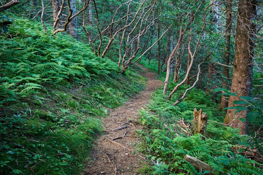
The trail swings off the right side of the ridge in short order, and this is where some of the more remarkable trail structures can start to be seen. The trail was built by members of the Carolina Mountain Club (CMC), who took no shortcuts and keep it beautifully maintained. The CMC is one of the oldest, largest, and most active hiking and trail-related clubs in the region, and their efforts should be greatly appreciated when enjoying hikes such as this!
At one point a seep or small stream - which can cease flowing during very dry spells - oozes beneath a stone bridge. Massive stone steps carry you up around a switchback and back over the same seep once again. There are more of these types of trail structures up ahead.
The trail will round the main ridge once more and come out of the spruces. The forest you will be traveling through now is more of a mixed high-elevation forest with mostly young trees. Stands of short, straight American Beech trees, where the ground is covered with soft grass, appear at points along the way.
The beeches are under attack by a non-native disease complex consisting of an insect and fungus working in cohorts with one another. Just like the Fraser Firs, the American Chestnuts (now completely devastated), the Dogwoods and the Hemlocks, the ultimate fate of the beeches after the disease spreads everywhere they grow is still unknown.

Luckily, a few of the beech trees do seem to be naturally resistant to the disease - unlike the Hemlocks, Fraser Firs, and Chestnuts, which experience nearly 100% mortality due to their respective killers. Look for brown or orange colored leaves on affected trees during mid to late summer, often times sprinkled with the bright green of new growth as the trees attempt to recover. All the while, some individual trees remain remarkably unaffected.
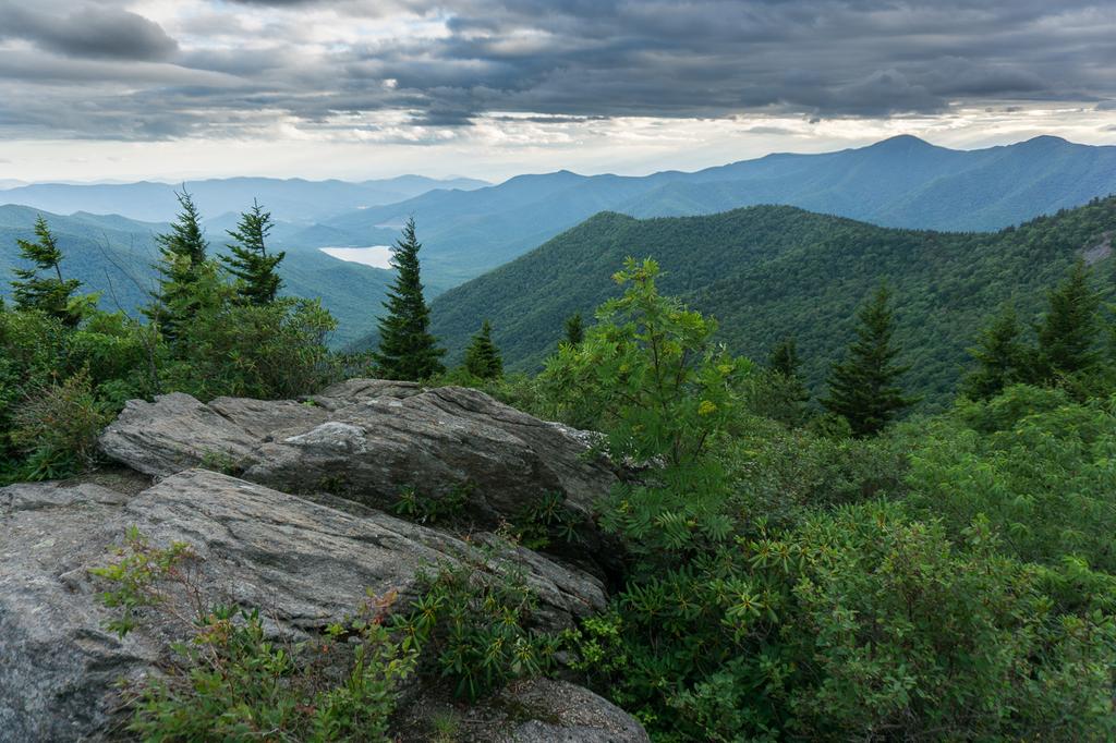
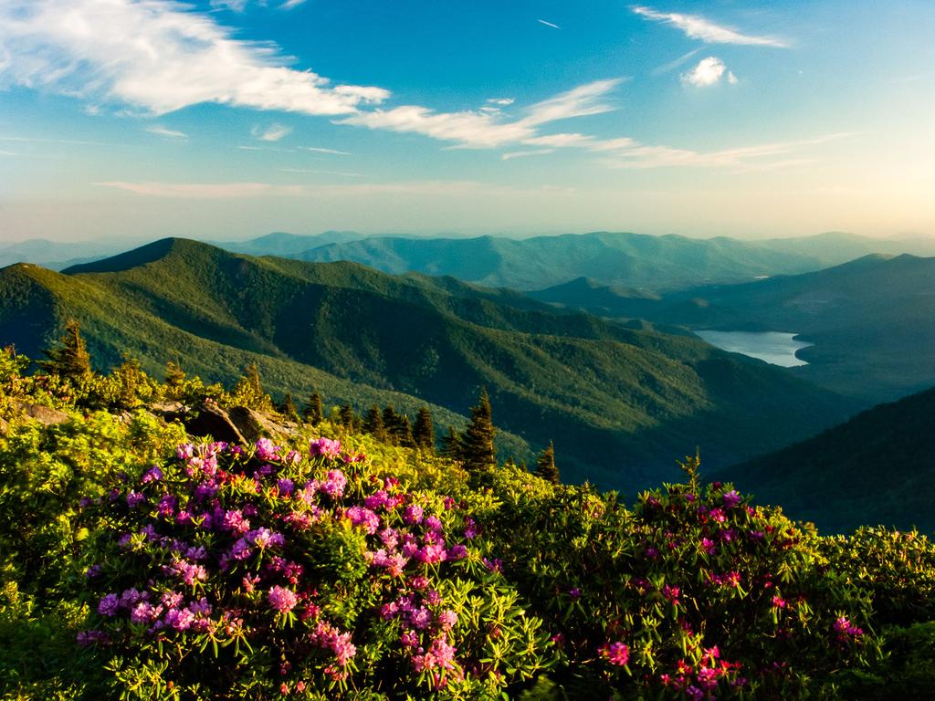
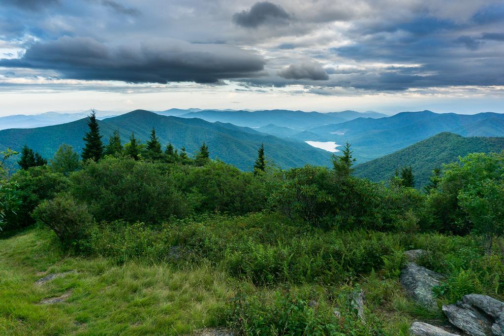
Interspersed within the forest are open areas that are, at certain times of the year, overgrown with wildflowers and blackberries. This is also where you will catch your first views of the valley below off to your left. The valley is the Asheville Watershed, and the large lake at the bottom of it is the Burnett Reservoir. Asheville has one of the cleanest water sources of any city in the country thanks to these forests, and the watershed is said to protect the largest contiguous stands of Red Spruce forest in the Southern Appalachians. The steep, rocky peak above you to the right is Potato Knob (summit elevation 6420').
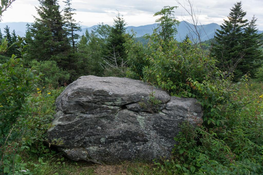
The trail begins to descend a bit, passing some rock outcrops on the right side, and then enters what's known as a "block field" - an area where stacks of rocks and boulders have fallen from cliffs or steep mountain peaks up above. These stone fragments were pried loose by freeze-thaw action, mainly during the last ice age.
Massive slabs of stone had to be moved to form the trail's surface. It's hard to imagine just how much effort went into hustling these boulders in to place for us to enjoy a nice, clear path across the rugged mountainside. Luckily, the trail surface here should pretty much never erode, ensuring future generation will be also able to admire this handiwork. The trail descends through a short s-curve entirely on massive, stair-stepped stones.
As you approach a ridge line arising from the slope below Potato Knob, the trail will climb through another s-curve with some stone steps, and then a spectacular view opens up to the left from a rocky outcropping.
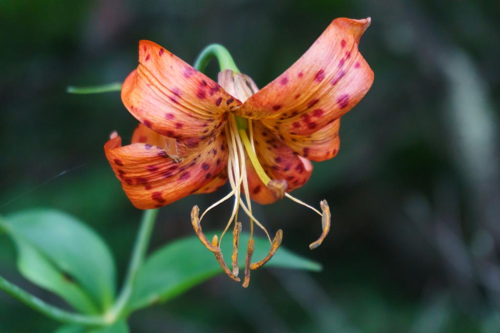
Continue just a couple hundred feet further up the trail through a grove of spruce and rhododendron to another opening which, during the spring and summer, is just brimming with wildflowers. You'll find (among others) Blackberry, Raspberry, Turk's Cap Lily, Daisy, Coneflower, Thistle, Bee Balm, St. John’s Wort, and Goldenrod (which blooms early this high up).

A large, obvious boulder sits alone in the shrubby meadow on the left side of the trail. A small side path leads up to the rock, and with a few footholds you can climb up on top of it. This rock marks the official end of this hike.
However, if you've still got some energy, the Mountains to Sea trail continues straight ahead and plunges back into deep, dark, mossy green spruce and fir forests as it resumes its (steeper) climb. It ascends to the top of the main Black Mountains ridge west of (a) Potato Knob, before going down through (b) Rainbow Gap and up to (c) Blackstock Knob. These would make nice extended destinations along this section of the Mountains to Sea Trail for longer hikes, with round-trip distances of about (a) 4, (b) 5 and (c) 7 miles from NC 128, respectively.
Enjoy the views, maybe have a snack and take some time to get re-hydrated, and then head back down to your vehicle the way you came to finish the hike.

This site is part of the
WNCOutdoors.info network
Western North Carolina
Hiking | Mountain Biking | Waterfalls
Advertising Information | Contact Us
©1996-2025 CC-BY-SA | Privacy Policy