This trail offers a walk along streams and ridge tops where remains of old homesteads and fields are evident. The vegetation changes from low, dense vegetation along the stream to cove hardwoods and piney ridge tops. Picnicking, water, restrooms and camping are available at Rocky Bluff Campground May through October.
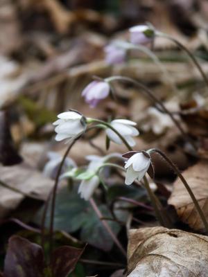
This trail follows Big Laurel Creek through a scenic gorge to its junction with the French Broad river at the old logging ghost town of Runion. This trail is especially nice in early spring when there are many wildflowers blooming along the path and riverbanks, and when the water levels are low and the creek runs clear. The creek is quite large by the time it enters the gorge - almost a river, perhaps explaining the trail's confusing name - and its popularity with boaters and fishermen.
The trail is an old railroad bed which used to carry logs to the Runion sawmill in the 1920's, and as such, is mostly level. However, it's rocky and rooty in spots, so do bring the boots.
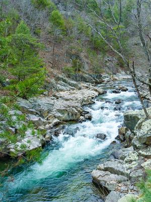
A few small streams flow across the trail at various points, and bluffs tower over the river making the valley narrow and enclosed with precipitous slopes on either side. Huge boulders choke the gorge forming raging rapids in places, and a few deep holes invite strong swimmers to take the plunge in warm weather. The trail nears its end at the former logging town of Runion. In its heyday, Runion was home to more than 1,000 people. Brick chimneys and crumbling foundations still remain - one of the few "ghost towns" in North Carolina.
The trail crosses the railroad at the confluence of the Big Laurel and French Broad, and ends on the other side of the tracks at a tranquil riverside flat. Trespassing on railroad property is dangerous, so just follow the trail straight across (after looking and listening for trains - this is an active line!) and do not attempt to cross Big Laurel Creek on the railroad bridge like some have in the past.
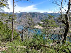
Climbs steeply from the Silvermine trailhead parking area to the Appalachian Trail, near the top of Lovers Leap Ridge. The Silvermine trailhead is across the French Broad River bridge from downtown Hot Springs. The main overlook, located at a rock outcrop just beyond this trail's intersection with the Appalachian Trail, affords panoramic views of the French Broad River, the town of Hot Springs, and the surrounding mountains.
At its lower elevations near the parking area, the trail follows the stream a short distance through an interesting "rock garden". There are some steep mountainside forests, and further up - through some switchbacks - some notable rock outcrops.
Can be used along with the Appalachian Trail to form a nice, 1.6 mile loop.
This trail offers a walk through oak-hickory hardwood forests. The trail provides access from Hot Springs to the Rich Mountain Fire Tower. There is loop opportunity with the Appalachian Trail.
**Note**: a wildfire affected parts of this trail in 2016, leading to some parts becoming overgrown in subsequent years.
This trail offers a pleasant hike through a hardwood-pine forest and along a cascading mountain stream known for its trout fishing. Once part of the Brook's farm, an old house foundation, rock fences and a cemetary remain. Picnicking, restrooms, water and camping are available at Rocky Bluff Campground from May through October.
This trail is named after a water pump near the trail. The pump delivered water to Runion, which is now a ghost town. The trail accesses the Appalachian Trail and may be used as a loop or as part of a loop with the AT. Aside from that, it doesn't really go anywhere, and despite some nice scenery, feels a bit aimless. One section of this trail starts descending into a neat cove, and then - your easy descent coming to a screeching halt - veers up out of the cove and onto the nearby ridge.
Starting at the tip of the River Ridge Loop trail, Jack Branch climbs along an old road bed in places, while in others it slips away to amble along the ridge. The forest burned in the early 2000s in this area, giving it an open feeling except where it has filled back in thickly with Virginia and Shortleaf pines. Follows the ridge between Jack and Murray Branches, but spends more time over on the Murray side. Has some limited wintertime views.
Joins with FS 468 and follows it for a bit before splitting off to the right to finish the climb up to the state line ridge and FS 422 in Cherokee National Forest.
Loop trail winds its way up a lush cove beside the West Fork Shut-In Creek and some of its tributaries. Passes several old homesites in a lush cove with big boulders covered in soft moss. Most of the creek crossings are bridge except the upper crossing of the main stream. You might be able to rock-hop but you might end up with wet feet. Connects with the Bluff Mountain Loop trail to make a longer loop option possible.
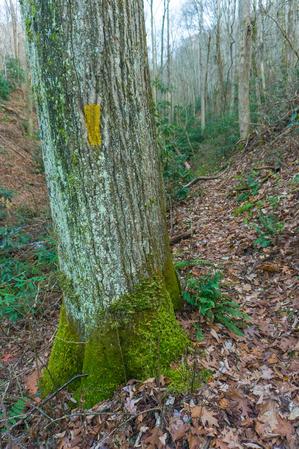
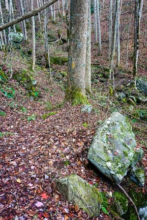
Following an old logging road, Bluff Mountain Loop trail winds its way up the West Fork Shut-In Creek drainage to an elevation of just over 3600 ft. It passes through a forest of mainly mixed hardwoods, including Tuliptree, Read and White Oak, Black Cherry, Red Maple and Sugar Maple. This lush north slope of Bluff Mountain sports dozens of big, round boulders capped with moss and ferns. There are (true-to-name) bluffs and boulder fields around just about every turn. The trail crosses the West Fork Shut-In Creek and several of its tributaries in an area of pretty cascades, and it the sound of running water is never far away. Abundant with wildflowers in Spring, this trail offers something for all seasons.
Starting from the Appalachian Trail junction at Garenflo Gap, this trail enters the woods and begins a steady downhill grade. Most of the way, the trail follows a creek on an old wooded road. In most places, the trail accommodates side-by-side walking for two hikers. To the right, the trail traverses some boggy sections, especially in rainy weather. Emerges onto SR 1183, Upper Shut-In Road.
This is a loop with a short section of out-and-back trail up to the loop portion. Described here in a counter-clockwise direction for the loop portion.
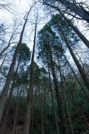
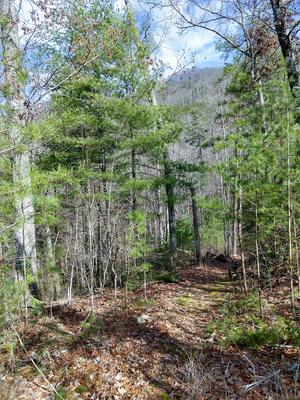
Starting at the picnic area, ascends the steep river valley on a nice, newly-built path through a young forest of oaks, Virginia pine, and various invasives. Has some superfluous railings in places. Crosses an old road bed, then loops through a switchback and up through a tiny cove where native White Pine grow tall. Joins the old road and follows it a bit, then you reach the loop portion of the trail. Turn right to split off the old road and head out toward the ridgeline. The trail curves left and follows the ridge, where views of the river open up in places. It's somewhat overgrown, though, making the views through the thick pines better in winter.
After a short jaunt along the ridge, the trail joins back to the old road at an intersection, where you can head left to close the loop. (To the right is the Jack Branch trail, which continues up the old road bed toward the state line ridge).
Turn left to continue the loop portion of the trail. This descends moderately through a fairly nondescript but pleasant enough forest to the initial split and close of the loop portion of the trail. Continue straight and retrace your steps to the picnic area to finish the trail.
Picnicking, fishing and vault toilets are available at Murray Branch Picnic Area.