Harper Creek Falls
At A Glance
TODO: #32 Boilerplate

8.5 mi round-trip
Difficulty Rating: 12.31 ![]()
Climb: Hilly ![]()
Tread Condition: Very Rough ![]()
Highest Elevation: 2440 ft
Climb Total: 1100 ft
Configuration: Loop with out-and-back extension
Trails Used: TODO dynamic list Raider Camp, Harper Creek, Mountains to Sea, unnamed trails
Begin the hike on the signed Harper Creek trail (#260) at the back of the parking lot. This trail immediately begins a steep climb up to the gap to intersect with Yellow Buck trail (#265).
This climb - on a section of trail constructed in 2006 - is not particularly well routed; it is eroding terribly in spots. It merges with an old road bed that was already terribly eroded before it became part of this new section of trail. It merges again, with the old official trail right before reaching the gap.
The old trail was well graded and not very eroded, but didn't have much parking at the beginning. So we get to use this new route instead. I guess that's better 🤷♀️
Anyway, bear left on Harper Creek trail, and start a gentle descent on an old logging road. The orange-blazed trail is mostly wide and smooth. It's easy to follow, with a few sandy, muddy, or wet spots and a couple of small branch crossings. You will come to a point that is about 30 feet above the creek with a nearly vertical slope down to it; the trail has eroded in places leaving only bare rock and a narrow tread, making for a sketchy traverse. Then the trail moves into an area with lots of campsites.
At the campsites and a large flat area, several side paths lead left; stay straight on the blazed trail. At a particularly good and large campsite, you reach the first intersection on the hike. It is signed. Both signs list the trails as "440", which corresponds to the Mountains to Sea Trail only. The Mountains to Sea Trail comes in from the left on what is also the Raider Camp trail (#277) and goes uphill, right, on the Harper Creek trail (#260).
You could go either way, but I like to get the relatively straight and steep Raider Camp trail out of the way and leave the excitement of descending Harper Creek for the last half of the hike. It's your call, but if that sounds good, bear left onto the yellow-blazed Raider Camp trail (#277) and immediately come to the first crossing of Harper Creek. This begins the loop portion of the hike.
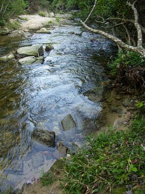
Here, you'll need to make a judgement call. This is the furthest downstream crossing you'll make on this hike (with the most water), but it's also one of the easiest. The creek is wide and threaded at this point, with many smaller channels, gravel bars, stepping stones and large boulders interspersed with clumps of grasses, shrubs, and wildflowers. If the water is so high that crossing looks difficult or dangerous, you want to turn around and come back to hike this another day - further upstream, the creek is narrower, the water swifter, and the channels more concentrated. I was able to rockhop this on my last visit, but it may well be a wade.
Once across, the trail heads downstream a bit, then climbs the bank on the right side. The trail at this point is blazed yellow and white (for the Raider Camp and Mountains to Sea trails respectively).
The trail heads upstream along the modest Raider Camp Creek. It's a steady climb, moderately steep, and it doesn't let up much, but trust me - it's the easiest part of this hike. Enjoy the rich woods and notice how laughably eroded the trail gets. In places, the old road bed has walls head-high on either side and it looks like it will keep on eroding as long as there is soft soil underneath. The water has nowhere to go but directly down the trail. This is a problem the Forest Service shouldn't have overlooked 20 or 30 or 40 years ago - it is way too entrenched to fix now without a full re-route of the trail.
The trail will pull away from the creek up the mountainside somewhat, then return to it at a small, hard-to-see waterfall before pulling away for good yet again. Along the way, you will see two primary types of evergreen trees: Eastern Hemlock and Eastern White Pine. The Hemlocks are more prevalent on lower parts of the trail and in coves, while the White Pines take over more at higher elevations on dry ridges. A mix of the two exists in some areas. The hemlocks are on their way out thanks to infestation by the Hemlock Wooly Adelgid; a lot of them are already dead.
The trail reaches the ridgeline, then swings left of it again in a patch of young woods. Most of the short, straight trees here are tuliptrees. You'll climb a bit further to the next intersection, where you want to proceed straight. The climb lets up from here and you'll enter another rich forest. As the trail swings around a ridge, the forest used to be full of shortleaf or pitch pines - I'm not sure which - but the Southern Pine Beetle wiped these out several years ago and it's largely shrub and sourwood trees now. The trail crosses some wet-weather seeps before coming to the next obvious intersection. This is where the easy hiking ends - prepare to use your map and route-finding skills extensively from here on out!
Here, the Mountains to Sea trail goes straight. Turn right onto the un-blazed, threaded path leading downhill along a ridge. This is an unnamed spur trail to an overlook (or it may now be considered an extension of the Raider Camp trail depending on which map you look at). This trail descends moderately through a dry ridgetop forest and gets quite a bit steeper near the end. There are a couple of forks; keep left and continue downhill on the most heavily used gully toward open sky. You should be able to hear South Harper Creek Falls off to your left.
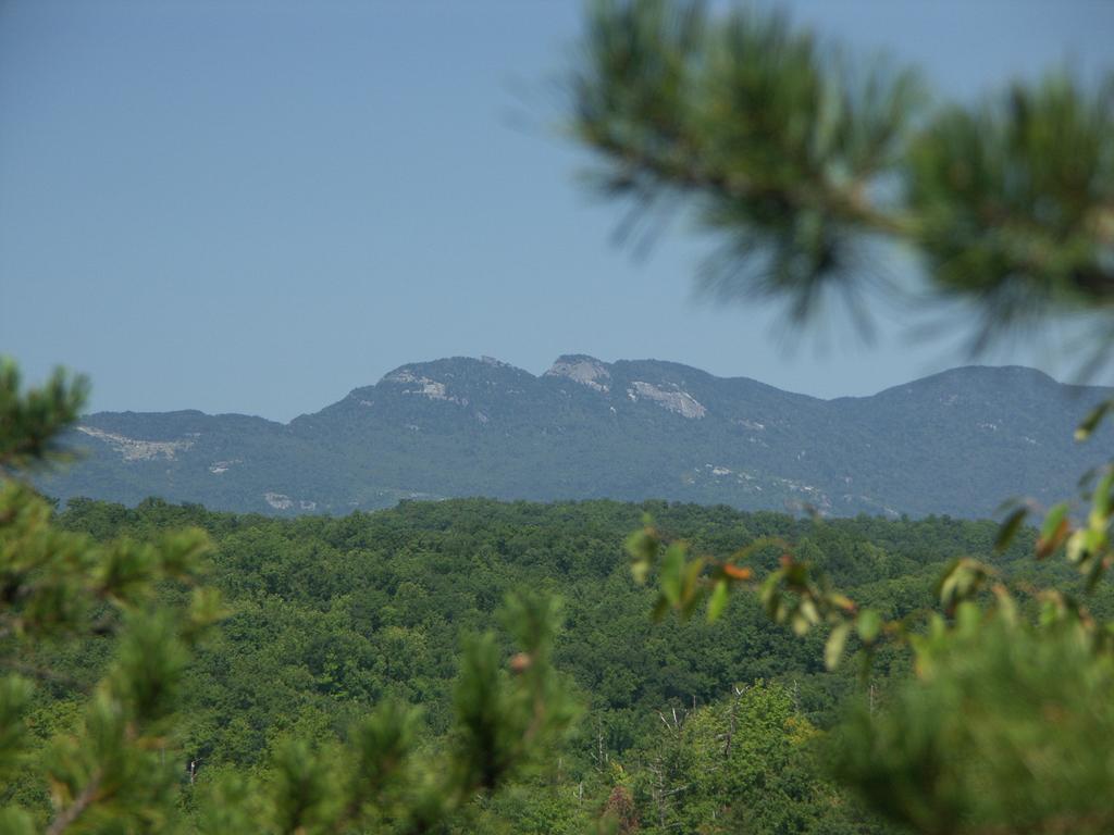
The path comes out at a rocky, high cliff point where you have a spectacular view of South Harper Creek Falls and Grandfather Mountain.
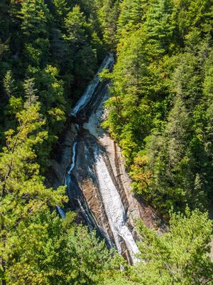
The creek slides down a very long rock face 300 feet below you, and the low ridges of the surrounding mountains rise steeply on either side. Ironically, this waterfall is not on South Harper Creek - just Harper Creek. Its name is presumably to distinguish it from the falls on North Harper Creek and the plan old Harper Creek Falls downstream from where both merge, which you will see later on this hike. To your right, far in the distance, lies the craggy peak of Grandfather Mountain. Enjoy the view, but be extremely cautious (it is not a smooth platform all the way up to the edge of the cliff) and stay well back from the edge.
Climb back up the gully path, keeping right this time. You are looking for the level, well-built connector trail that heads right from the overlook spur down to the Harper Creek trail at the top of the falls. Trouble is - at least as of the last time I hiked here - the connector was rather overgrown and hard to spot. (You probably won't see it on the way down, but if you do, take note of it).
Once you are on the connector, push your way through the laurel. If the path keeps on going, you have found the right one. There is a fork after 100 feet or so; both paths come back together shortly and you'll climb up and over a couple of rocky crags. The connector begins descending the slope toward the top of the falls on several segments with switchbacks in between, and once you know what to look for it's easy to follow. Consider bringing a machete and making it easier for the next person when you come!
The connector will descend into a small side cove which empties into Harper Creek at the top of South Harper Creek falls. The last few feet descend over a large rock with neat, natural stair-steps carved into it. An old tire was leaning against the shrubs to the right last time I was here, but don't count on seeing it. About 100 feet upstream is another nice waterfall, but that one may be on private property so don't approach it. Across Harper Creek is a large, angled rock and you will want to cross there. You may be able to rock-hop, but it may also be a wade. Remember: you are at the top of a high waterfall, so if the crossing looks to be unsafe to you, turn around. The trail resumes at the top of the angled rock and leads uphill a very short distance to the main, blazed Harper Creek trail, which sort of joins in from the left.
Bear right at the intersection (straight, really) onto the orange blazed Harper Creek trail leading downstream. You'll pass the very top of the falls and then the trail switches back several times as it descends toward the base through a hemlock forest. The path is rather steep and rough at this point - some sections are highly off-camber and very slippery. As you descend, you'll see several side paths that head toward the falls, but these are not recommended. Continue downstream where you will come out at the creek below the falls once it settles down a bit.
From here, a tough scramble will take you upstream to the base of the falls in a neat, amphitheater like area with sloping rock walls all around. The trail and hike continues downstream on the other side of the creek. This will be your first of 10 crossings of Harper Creek on this section of trail (for a total of 12 on the hike, including the very first one on the Raider Camp trail and the one just upstream from the falls).
The creek crossings are your main obstacle from here down to the last one above Harper Creek Falls. Each crossing has a bit more water than the one before. I was able to rock-hop 7 out of 10 of them last time I hiked this, but the last 2 of those 7 were a bit dicey in terms of staying dry. You may have to wade a majority of them and the last 3 of the 10 total crossings will be a wade no matter what. You'll also have to look carefully for the orange blazes on rocks at crossings - especially on the other side so you know where to emerge from the water. The rushing water and blaring sun tends to make blazes on rocks fade quickly, and blazes on stream side trees may be destroyed when trees get washed out by their roots during floods. But only one of the crossings had no blaze at all, as of last time I hiked, so it appears that blazing the crossings is a fairly high priority for trail maintenance folks.
This is an area under study to become wilderness, and in a lot of ways it is very much like wilderness travel. Overall, the trail isn't made terribly difficult by climbs or roughness, but by the fact that it is sparsely blazed between creek crossings and very little traveled. The crossings and constant hunting for the right trail will take its toll. It gets heavily overgrown in places, it is very narrow, there are lots of confusing side paths almost as well-worn as the main one, and it is tight and twisty with lots of short ups and downs. The path will come out on the rocks at the edge of the stream without crossing it a couple of times as well, so look for those blazes to know when to strike out through the water, and when to just return into the woods on the same side.
If you're used to wilderness travel, this will be no big deal. After all, true wilderness trails have no blazes at all! But for those who haven't had much wilderness or pathfinding experience, this wouldn't be a bad place to start experimenting with it in order to get an idea of what to expect. It's not terribly long, and the few blazes that are there do help. Your first trip on a trail such as this will likely be taxing. People write me all the time, saying they were surprised by just how exhausted they were after this hike, and how happy they were to see the car!
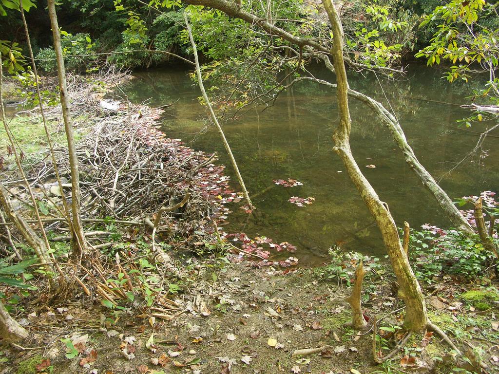
So for all the trouble, why even hike this trail? The scenery along the bottom of the gorge here is fantastic. The forest is lush and dense; the streamside areas are vibrant and healthy. Look for numerous signs of past flooding on this wild, free-flowing stream, such as piles of leaves and sticks stuck in the forks of rhododendron bushes waist-high. Sandbars, gravel bars, log jams, and natural rock levees attest to the power of the water during flooding. Large boulders force side streams into small waterfalls as they trickle into the main creek. You may be lucky enough to see some felled trees and beaver dams on the lower portions of the trail. And if you're even luckier, you'll see a beaver, but the chances of this are pretty slim.
Bear in mind that if you are caught here during a summer thunderstorm, or if one happens upstream, flash flooding isn't out of the question and it may be a long time before the water receeds enough to safely cross. You are far from help here, so be prepared. Do you have enough clothing, water, and supplies to spend the night in an emergency if you should become flooded out, injured, or exhausted? If not - don't hike this trail!
After the 8th crossing, you'll come to the intersection with the Mountains to Sea Trail. Remember how that trail turned right back at the big campsite? This is where it ends up. Bear right, continuing downstream. The trail is a bit smoother, wider, and more well traveled from here on out. North Harper Creek (which the Mountains to Sea Trail follows) empties into Harper Creek here too, making your chances of rock-hopping the next two crossings almost nil unless the water is very low.
Eventually, you'll come to the final crossing which is not far above Harper Creek Falls. The trail gets a bit steeper and rougher and climbs some to pass around the falls. To get to the base - if you have the energy - continue down the Harper Creek trail a ways beyond the top of the falls to where it joins an old logging road at an angle. Turn right, and take the ridiculously steep and eroded path downhill to reach the base just before you get to the falls. A sketchy rope was tied to a tree here to make descending the last few feet possible, but it was frayed and wet.
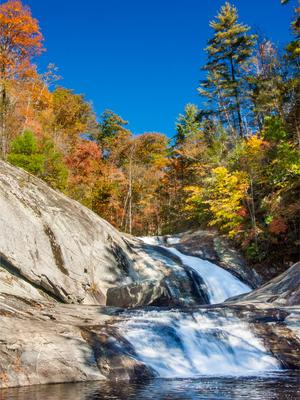
The pool at the bottom of the falls is one of the finest swimming holes anywhere in the world (surely), but the ropes that you sometimes find strung up the sloping rock are misplaced and unattractive. Don't encourage this - if you go for a swim, just enjoy the bottom pool and don't try to climb up the falls. Some people even slide down the lower drop, but this is definitely not recommended. No photographs can capture the true enormity of the scene, but you can sure try; on a well-lit or overcast day, it's a fine opportunity to take a shot. Once you've seen enough, climb back up to the logging road, go right back to the main path, and head downstream.
The falls is where most people turn around when coming from the parking log, so the path is wide and relatively easy from here, aside from a few badly eroded spots. It's a short distance back to the intersection at the campsite - which will probably be a welcome sight by this point. Turn left, and return to your vehicle on the same trail you came in on to end the hike.

