Stone Mountain Loop
At A Glance
TODO: #32 Boilerplate

4.5 mi round-trip
Difficulty Rating: 6.84 ![]()
Climb: Hilly ![]()
Tread Condition: Moderately Rough ![]()
Highest Elevation: 2306 ft
Climb Total: 905 ft
Configuration: Loop with out and back extension
Starting Point: Upper Parking Lot
The Stone Mountain Loop trail was created with visitors' desire to see everything the park has to offer in mind. As such, this trail is composed of a mishmash of older existing trails and roads, and trail conditions and scenery along the way is quite varied. Some sections of trail are purpose-built while others follow old roads. In general, the trail is never too steep or difficult and is appropriate for groups and families with older kids.
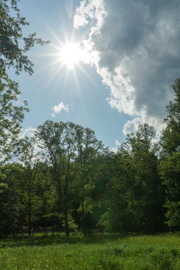
Starting at the upper parking lot, the trail winds through a meadow not far from Big Sandy Creek before beginning a short climb into the woods. At an old chimney, the trail forks, which marks the start of the loop portion of this hike. Bear right here to begin a gentle climb toward Stone Mountain.
The trail is an old road for a bit, and passes through a small clearing, then turns west to re-enter the woods. The trail is wide and easy at this point, a graveled path, and the forest is generally open. A smattering of rhododendron and mountain laurel grow in the understory. There are more of these farther along, while much of the forest is filled with grasses from here to the summit.
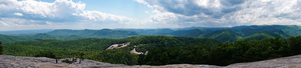
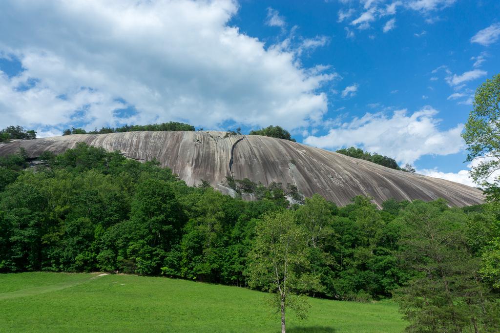
Before long the trail passes across a large rock outcrop. It re-enters the woods, and crosses another outcrop with fantastic views to the northwest and of Stone Mountain looming above. This would be a great destination for those with physical abilities that would prevent them from reaching all the way to the summit - you get a great sense for what it's like at the top from here. Continuing northwest, the trail winds along a ridge through open, grassy woods. It descends slightly before beginning uphill on the final push to the summit of Stone Mountain, through switchbacks which make it a relatively easy climb.
The graveled trail continues through open woods, while the trees get smaller and smaller near the top, before yielding to pines and disappearing altogether as you come out of the trees at the summit. Descend slightly behind the summit sign to reach the open, rocky expanse of the southwest slope of Stone Mountain, with its unparalleled views from the Blue Ridge out to the Piedmont. There is more than plenty of room to enjoy the view safely without going anywhere near the edge, so stay far back from it for safety.
Past the summit, the trail begins descending on a rougher tread with many steps through a forested area of mixed pines and scrubby hardwoods. The understory is not open anymore - it's filled with shrubs such as mountain laurel and rhododendron which bloom in late May.
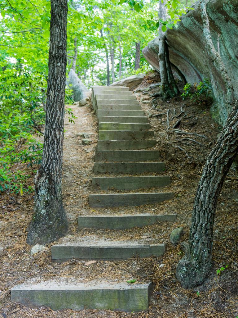
The trail pops out on another open rock outcrop, which you descend with the help of a wire rope fence if need be. It goes through another patch of trees on lots of steps before coming out on a final part of the outcrop. This one is traversed via a big stairstep structure rather than the natural surface, which would be too steep to walk on comfortably.
Then it's back into the woods on a steep course which descends quickly through switchbacks and lots of rock steps, passing some neat rock features along the way. The trees grow big again, and some of the white pines are quite large as you reach the next junction - with a gravel road. The loop trail continues straight across.
On the other side of the road, the trail descends for a bit, culminating in a set of steps, to meet the junction with the spur to the Lower Parking Area straight ahead. To continue on the Stone Mountain Loop, turn left here and descend to a creek crossing, then start winding up the ridge on the other side of the creek. Next, you'll reach the intersection with the Wolf Rock trail on the right. Continue on the Stone Mountain Loop trail to the left.
This section of trail is purpose-built, and it soon follows a small stream uphill, crossing it a couple of times on foot bridges. The road to the Hutchinson Homestead is on the other side of the creek, so you may hear cars on the road at times, crunching gravel under their tires. The trail passes through thickets of rhododendrons, and the creek becomes smaller and smaller until it disappears altogether just before a connector to the Hutchinson Homestead, on the left. It's worth the side trip to the homestead, which doesn't add any extra distance to the hike.
The connector crosses a deep gulch above the head of the stream which will be dry in all but the wettest conditions, and then pops out into the clearing for the homestead. Ahead are the historic buildings with interpretive signs, with Stone Mountain looming above. Drinking water is available at the homestead site during the warmer months.
After spending some time checking out the historic site, continue on the Stone Mountain Loop trail. You can either take the connector path back across the bridge and turn left, or just take the path out of the homestead area southeast toward the big meadow. Both trails join together at the far side of the meadow, which offers the best view of Stone Mountain's main southwest rock face - a spectacular scene. Benches are provided for relaxing while you enjoy the view, and a spur trail enters the woods at the mountain side of the meadow to reach its base. When you're ready to proceed, find the trail leaving the side of the meadow opposite the homestead.
Just after it re-enters the woods, you reach an intersection with the Black Jack Ridge/Cedar Rock trails on the right. This hike continue straight on the old road, but you can combine the two intersecting trails into a loop for some extra mileage and extra views before returning to this point if you wish.
Continuing straight ahead, the trail begins descending slowly as another small stream gathers in the valley bottom. This part of the park is green and lush, with ferns and mossy rocks in the tiny stream and rhododendron thickets in places. The trail crosses the stream a couple of times - at each, a foot bridge and a ford are provided as ways across. You can probably rock-hop each but the foot bridges will ensure you have dry feet by the time you reach the next junction, with the Middle/Lower Falls on the right. That trail is a short out-and-back to a couple of small slides and cascades on Big Sandy Creek. The main event, Stone Mountain Falls, is straight ahead, but the side trip may be worthwhile if you want to add some mileage to the hike. Don't expect anything too dramatic at these waterfalls, but they're still nice.
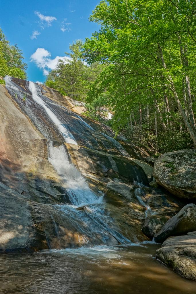
Continuing on the Stone Mountain Loop toward Stone Mountain Falls, you're now heading upstream along Big Sandy Creek, which is considerably larger than the tributary you were following before. The trail climbs a couple of sets of steps beside some small slides & cascades before the big staircase coming down beside Stone Mountain Falls. Turn right down the last flight of steps to reach the base of Stone Mountain Falls. Stone Mountain Falls is a high, steep slide culminating in a pool surrounded by a jumble of huge boulders. Chances are, if you haven't seen many people on the trail up to this point, you will now. This is what many people who hike in the park want to see.
When you're done at the falls, continue back to the staircase and ascend. There are hundreds of steeps, and it's steep. This structure was somewhat controversial when it was constructed, due to its out-of-place appearance in an otherwise natural area. It was necessary, however, to help the crowds ascend the steep slope beside the falls, which barely has any soil overlying the domed rock face below. About 3/4 of the way up, a structure extends right out to a good view overlooking the falls. It's a safe way to get a view from the top as the water drops away below.
At the top of the staircase, you'll come out onto the rock next to the stream. Stay behind the safety fences here - one slip and it'd be a very long, fast, and dangerous journey straight to the bottom. There's a good view of the stream accelerating over the brink of the falls with the mountains stretching away in the background.
After the top of the falls, the trail ascends back into dry woods over a gentler climb back to the chimney and the close of the loop. Turn right to head back to your vehicle, through the meadow, and finish the hike.

This site is part of the
WNCOutdoors.info network
Western North Carolina
Hiking | Mountain Biking | Waterfalls
Advertising Information | Contact Us
©1996-2025 CC-BY-SA | Privacy Policy