Old Mitchell
At A Glance
TODO: #32 Boilerplate

4 mi round-trip
Difficulty Rating: 6.39 ![]()
Climb: Hilly ![]()
Tread Condition: Moderately Rough ![]()
Highest Elevation: 6700 ft
Climb Total: 975 ft
Configuration: Loop w/ Out-and-back extension
Starting Point: Mount Mitchell State Park Restaurant
Trails Used: TODO dynamic list Old Mitchell Trail, Camp Alice/Mountains to Sea Trail, Commissary Trail
Begin the hike at the south end of the parking lot near the restaurant, where the Old Mitchell trail leads uphill behind the map and sign board, turning left. You'll pass the employee barracks on your right.
The trail then heads uphill through an open area filled with raspberry and blackberry canes, which become ripe in late July and early August at this altitude. Some good views, back toward the restaurant and surrounding mountains, can be seen from here. You'll cross directly over a low summit along the main ridge, but it's not very high. On your left will be a green water tank. You'll descend slightly into a gap, re-entering a stand of firs, and then bump into the park road on your left.
From here, the trail veers right and drops just off the crest of the ridge. This is a section of trail I helped build as a park employee in the summer of 2001. It goes up-and-down as it winds around some large rock outcroppings. You'll encounter several sets of log and rock steps and a neat paper birch tree. The trail then starts descending steadily through what is now a young forest. This area was open and grassy back in 2001, and before that a forest in the early 90's.
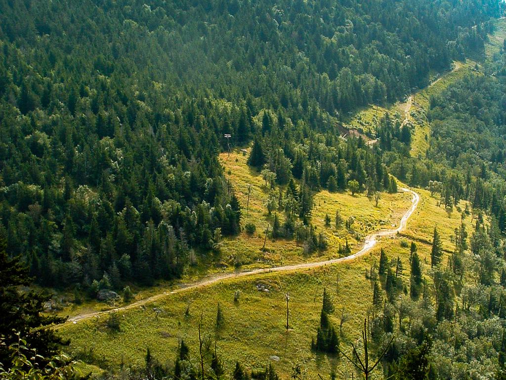
Up to this point, the trail has been going up and down, but it now starts decidedly downhill. It will lose a couple hundred feet in elevation before it starts climbing again. And it becomes much more rocky and difficult on this stretch. The difficult section starts by dropping precariously off a wet, slippery rock outcropping. The first drop is quite steep and eroded, and the big ankle-grabbing cracks between the rocks nearly always filled with muddy muck. Be careful here. (By the way, this drop-off is where the stretch of trail I helped build ends. I wasn't responsible for it or the next 1/2 mile or so, which wasn't completed until two years later in 2003!)
Shortcode: Gallery Here
The trail descends, sometimes steeply, into a Fraser fir forest, and the surroundings become wetter. Several very large Red Spruce trees survive in this area which is slightly lower in elevation, though there are many dead ones as well. Taking the place of the dead spruces are mountain maples, mountain ash, birch, and beech, as well as young spruce and fir.
There may be lots of slippery mud on this section after rainy weather, and a bit of running water can't be ruled out either. Many sets of wood and rock stairs carry you up and around rock outcroppings and particularly wet spots along the way, and there's a large bridge structure that carries you over one of them. But you'll get some nice views of the summit as you approach it, and to your right, there are some great views down to the Camp Alice area. Camp Alice is an old logging and tourist camp, which you will be visiting later on during this hike.
The trail resumes climbing in earnest again shortly, over a very rocky stretch, and you'll reach the intersection of the Camp Alice/Mountains to Sea trail in a dense stand of almost pure Fraser Fir trees.
Turning right here would take you down to Camp Alice. But first, you'll want to go to the summit itself - it's not far. So turn left to begin the out-and-back portion of this hike. You will return to this intersection after exploring the summit area.
The trail climbs moderately through a couple of switchbacks, after emerging from the stand of firs into a clearing of sorts. But vibrant, young firs are starting to grow in abundance between here and the summit and may eventually take back over the landscape before succumbing to the exposure or Balsam Wooly Adelged infestation again. It doesn't take long, at the rate they can grow in good conditions, for them to block out light and form a dark canopy over the trail. Nor does it take long for them to be wiped out again, an entire cycle lasting perhaps 50 or 60 years.
At the top of the clearing, you'll pass through a switchback and reach another intersection. The park road is straight ahead of you. This flat spot is the location of the old summit parking area before the road was extended, now carrying tourists up to the larger parking area closer to the top.
The trail to the left leads down to the campground, so turn right here to go up toward the summit. You'll enter another stand of Fraser Firs, which get shorter the higher you go. This very rocky section of trail climbs alongside the park road so you may hear cars to your left. You've reached the developed summit area once you get to the wide, paved path.
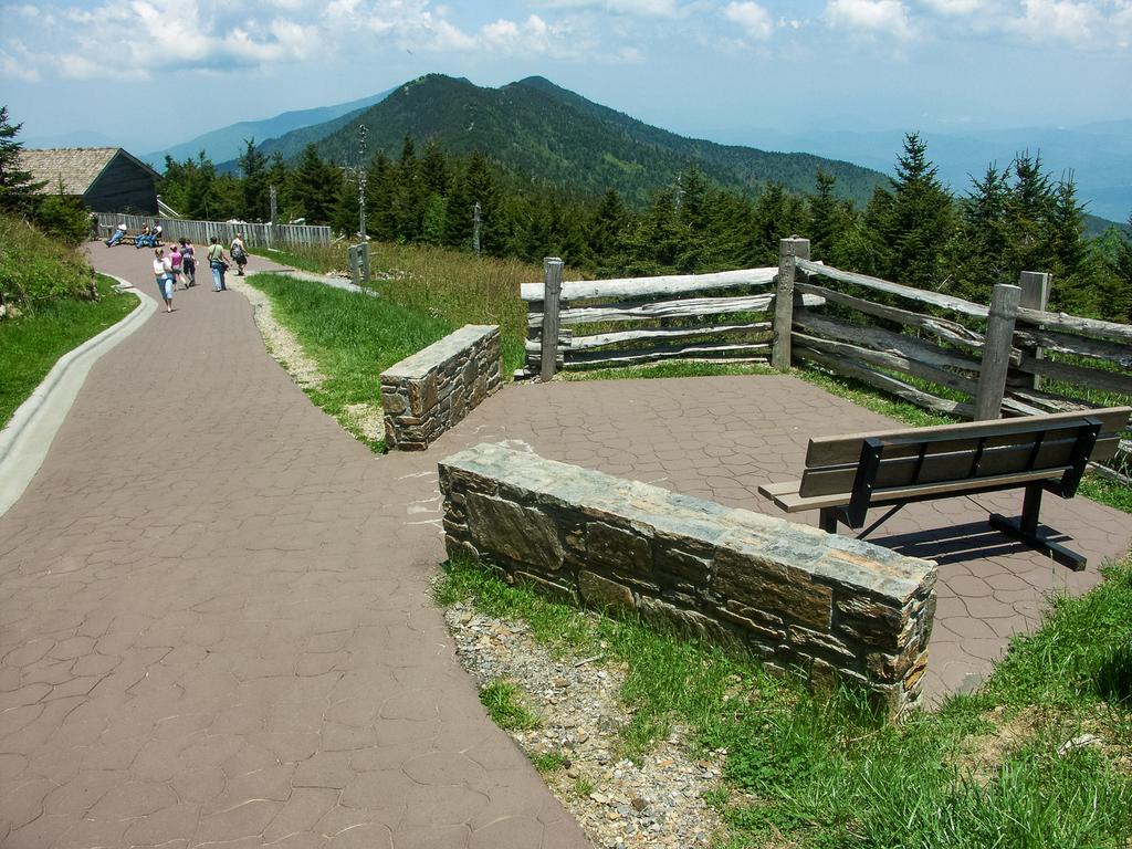
You are now 1 1/4 miles above sea level! There used to be a sign stating as much, although it was gone last time I visited. Though you probably won't notice any thinning of the air, you're in an alpine environment here and it can get quite harsh at times, even if conditions were mild up to this point. It's a rather exposed mountaintop, so do come prepared for the weather.
Shortcode: Gallery Here
There are a few things to explore in the summit area. Turn right and follow the pavement a few more steps to reach the new observation platform on the summit itself. Or go left to reach the concession area, museum, restrooms, and picnic area. An optional loop around the Balsam Nature Trail will provide more insight into the high-elevation forest - and the path ends back at the main parking area. Take some pictures, maybe enjoy a snack from the concession stand, or a lunch in the picnic area. Especially if you are not driving up later, be sure to check out the excellent new museum.
There's more to see in the park, so when you're done exploring the summit, head back down the Old Mitchell trail the way you came to continue the hike. Turn left at the junction with the campground spur, toward Camp Alice.
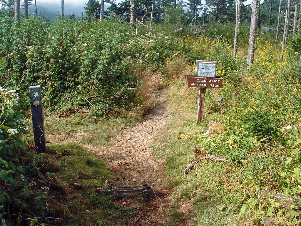
From here it is 3/4 mile down the mountain to Camp Alice. Keep straight at the intersection with the Old Mitchell trail on your right. The trail becomes the Mountains to Sea/Camp Alice trail, which resumes the loop portion of the hike.
This stretch of trail descends steeply through a mixed forest of spruces, firs, and hardy deciduous trees, such as mountain maple, birch, and mountain ash. You'll hear the trickling of water during wet weather, which increases to a rushing sound as you descend. After crossing some ephemeral tributaries, you'll emerge from the forest onto a gravel road called the Commissary Trail. There is another directional sign here.
To the right, as the sign states, it is 1 mile back to the park office, your vehicle, and the end of the hike (see below). But you may want to explore out to Camp Alice and Commissary Ridge first. Doing so will add up to 1.4 miles to the hike's overall total.
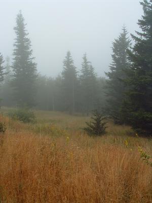
To the left, it's 0.7 miles to a popular National Forest campsite on Commissary Ridge. The way is nearly level, and travels through spectacular alpine scenery, making it a highly recommended out-and-back side trip. Almost immediately, you'll cross cascading Lower Creek as it flows over the road, but it should be an easy rock-hop to keep your shoes dry. You'll then pass through the area known as Camp Alice, which is the open clearing on the other side of Lower Creek.
This is the site of the terminus of the Mount Mitchell passenger railroad. This railroad operated through the early 1900's, after being used as a logging camp in the years before. Several structures, both logging and tourist related, were built in the area over time. Most traces of the camp itself have vanished, except the old road/railroad beds and the clearing.
A gravel park road veers left shortly. Continue straight on the unimproved road bed which becomes more of a trail. This level old railroad grade is an incredibly scenic, easy walk. Thick, intact patches of spruce-fir forest line the edges of grassy clearings, and clumps of blueberries and rhododendrons grow along both sides of the road. This side trip is especially recommended when the blueberries are ripe in early August, but do take note: bears love the sweet ripe fruit too! (The area is marked and closed when bear activity is high here, so you may want to check with the park office before your hike).
When you're done exploring, return to the Camp Alice trail intersection back across Lower Creek.
(Continued) The Commissary Trail, from the Camp Alice trail to the park office, is a gravel road with a slightly uphill grade. This easy walk takes you back into a forest of mostly northern hardwoods, before returning into an area mixed with spruces and firs. You'll go around the open, grassy ridge below the park's restaurant. There is an excellent view back toward the summit from here. After skirting the unnamed peak behind the park office once again, you'll arrive back at the park office.
Turn right up the stairs to the office, then turn right again and take the Old Mitchell trail at the end of the sidewalk, leading up the hill beside the park office. You will ascend moderately through fields and brambles where large Fraser Fir trees once stood. Thanks to Balsam Wooly Adelgid infestation, all that remains in this area are tall, dead gray skeletons or fallen logs, and succulent saplings.
In fact, this is one of the most evident things along this hike: the rapidly changing forests. Since I first hiked this trail 25 years ago, sections of ridge that were once open and grassy are now covered in a dense stand of trees; sections which once looked like ancient forest are now open and filled with berry canes. Very little hasn't changed.
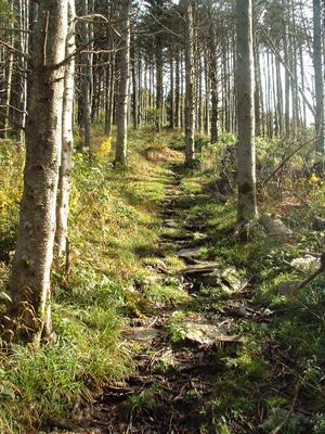
As you continue to climb, you reach the remaining edge of a standing, live forest. The trees start out thin at first, but then you enter a relatively healthy stand where it is possible to imagine what these mountains must have looked like before the adelgids began ravaging the fir forests. The boundary is rapidly moving, and this stand will likely be gone soon as "fir waves" approach and wash over the trail.
The trail levels out, swings left and skirts around this unnamed peak. This section, like much of this trail, is quite rocky and rooty. Some wet and muddy spots may exist as well.
The trail will then descend into the gap occupied by the park restaurant. Go straight across the lawn and continue straight on the walkway over to the parking lot to finish the hike.

