Grandfather's Profile
At A Glance
TODO: #32 Boilerplate

7.6 mi round-trip
Difficulty Rating: 12.97 ![]()
Climb: Climbs Steeply ![]()
Tread Condition: Moderately Rough ![]()
Highest Elevation: 5964 ft
Climb Total: 2300 ft
Configuration: Out-and-back
Starting Point: Profile Trail Parking Area on U.S. Hwy. 105
Trails Used: TODO dynamic list Profile, Grandfather
Begin the hike at the back side of the restrooms building. This well-constructed new segment of trail (opened in 2017) traverses the slopes at an elevation of just around 4000 ft. A large, sturdy bridge spans a gulch near the beginning, and then the trail travels up and down some on timber steps.
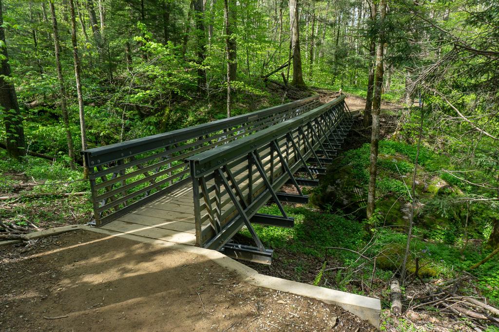
It's a beautiful northern hardwood forest you're hiking through with a few Red Spruce and Eastern Hemlock mixed in. It's a beautiful start to the hike, but you'll enjoy the sights of nature more than any sounds since you're right beside the busy highway and it's rather noisy with trucks and other vehicles coming up the steep grade at high speed. (In fact, the only real complaint I'd have about this hike, besides the crowds, is that the faint sound of traffic - especially motorcycles - stays with you all the way to the summit).
A short series of switchbacks carries you down a descent to the fledgling Watauga River. This is where the new section of trail joins the original, and the old Tweetsie Railroad bed is across the river here. You'll see the old trail coming in from a creek crossing to the left, now closed. The trail continues following the Watauga downstream for a short distance, losing just over 200 ft. of elevation from the parking area. Remember, this means you'll have to finish the hike with a climb on the way back, so save some energy!
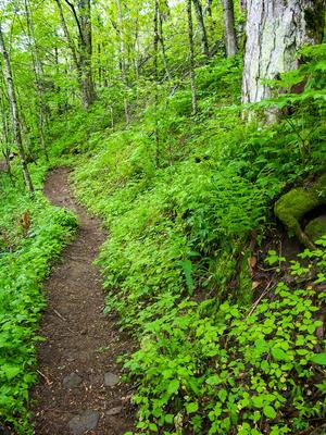
The trail undulates up and down some, with a few side curves into smaller adjoining coves where tiny streams or seeps flow in. There are some great photo opportunities here with wildflowers in spring, and it's a nice easy hike. The forest at this point is mostly mid-elevation and cove hardwood trees, with plenty of rhododendrons in the understory.
After less than 1/2 mile, the trail swings right and begins climbing. It's not too difficult at first, and the trail is well-graded and well-maintained. (Last time I hiked here, in 2021, a major bypass was under construction in this area. A ranger we met indicated that it should be open within a few months, bypassing a formerly steep, muddy, and eroded section).
You'll see the first handy milepost beside the trail. These are present all the way to the top of the mountain and indicate how far you've gone (or have left to go on the way back). There are some roots and rocks to contend with, but nothing major.
The trail winds its way up onto a low ridge with lots of beech trees, then heads back into a larger cove where you cross a stream. Some rather large trees grow here (as they do all the way up the trail to the spruce-fir zone).
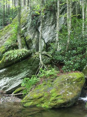
The trail exits the cove and dips into the next one, where you cross scenic Shanty Branch on very large, parallel rectangular stepping stones. A small cascade is just upstream, and a larger one is just downstream. The trail swings left, downstream, to pass through the cleft between a big bluff to the right and a boulder that split off the bluff to the left, next to the cascading stream.
The trail climbs again past the bluff, and gets a bit steeper, but not terribly so. It wraps into progressively drier coves as far as running water goes, but lush carpets of greenery and wildflowers still grow on the rich soil of the forest floor. The rhododendron fades away, and is replaced by Hobblebush (Viburnum lantanoides) which has neat white flowers in mid-May. The trail then begins a series of switchbacks taking you to progressively higher elevations. A few more Red Spruce trees start to mix in with the hardwoods as you move through 4000 to 4500 feet in elevation.
Foscoe View makes a nice little rest stop at approximately the halfway point of the hike (distance-wise), with limited vistas to the north and west. You can see lots of development on the surrounding mountains, making it apparent why protection of land on Grandfather Mountain is so important, and the view stretches to the Amphibolite Mountains and even the mountains of Virginia near the horizon.
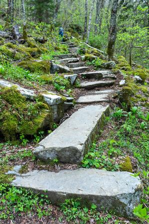
Beyond Foscoe View, the trail starts getting rockier, but most of the rocks are artfully arranged in a stair-step fashion. Another series of switchbacks will provide more (wintertime) views up to the looming Profile Cliffs on Green Ridge above you. You'll soon reach the Profile campsite on the left.
The section of trail just beyond the Profile campsite goes through a wetter area as it swings back to the southwest, but it is almost entirely paved with hundreds of huge, flat stones. Named "Peregrine's Flight", this part of the trail is as outstanding to the world of trailbuilding as the infamous Linn Cove Viaduct of the Blue Ridge Parkway on the opposite side of Grandfather Mountain is to roadbuilding.
The trail was built by Kinny Baughman and Jim Morton using nothing more than hand tools - iron rods, shovels, pulleys, and winches. According to rangers I've spoken with on the mountain and an article in the Mountain Times, it was built between 1985 and 1989 in order to replace the soon-to-be-obliterated Shanty Trail and preserve hiking access to the west side of Grandfather Mountain. Baughman is quoted as referring to the Profile Trail as his "lasting legacy", and with that I'd agree - the course of this walkway, defined in stone, looks like it could easily be here for centuries, and it is a true pleasure to hike!
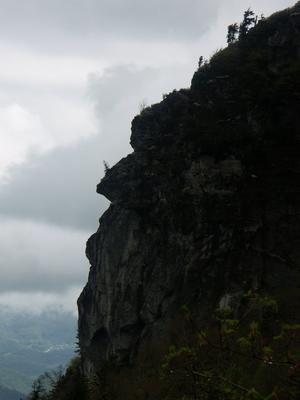
After passing a few more switchbacks and rock outcroppings (and the 5000 ft contour), the next view you'll see is of the Profile Cliffs and is called - appropriately - Profile View. This is one of the views which give Grandfather Mountain its name - the rocks do indeed look like the profile of an old man's face. Another view, from along highway 105 near Foscoe to the north, shows another way the mountain could have been named. From that view, the old man looks like he's lying on his back.
Around this altitude, also notice how much deadfall is on the ground, and how many broken limbs the standing hardwoods have in their crowns. This is the result of some very severe ice storms that have hit the mountain in the 2000's. Some of the standing deciduous trees are little more than a huge, thick, sturdy trunk with not much to show in the way of branches - those having been stripped off by deep snow, ice, and fierce winds.
The hardiest of the trees survive, and some are quite old, but they have had a rough time of it. This partly explains why the Spruce and Fir trees become more common at these higher elevations. Even though Red Spruce, for example, seems to grow faster in warmer temperatures found at lower elevations, they're less prone to damage from winter weather than the hardwoods, making it easier for them to compete for sunlight up here compared to those that sprout farther down slope.
The trail continues up to cross the uppermost reaches of Shanty Spring Branch, with the water running cold and clear between huge channels in the boulders. The spruce trees begin to dominate the forest as you climb, and a few Fraser Fir - which only grow at the very highest elevations of the Southern Appalachians - start to mix in. The trail gets steep, rocky, and wet on its last leg up to the piped spring and the small bluff that overhangs it.
Shanty Spring is a historic spot on Grandfather Mountain, and for good reason - this is the last sure water before the summit and the closest sure water to the summit if you're hiking the Grandfather trail. The spring is piped, so fill up before continuing. But as the experts, doctors, and multiple signs posted here will tell you: filter or treat water from natural sources before drinking it to be safe. Since I sometimes recklessly ignore experts and signs, I have had some very delicious, cold, untreated mountain water from this spring without any problems myself. (But don't do that!)
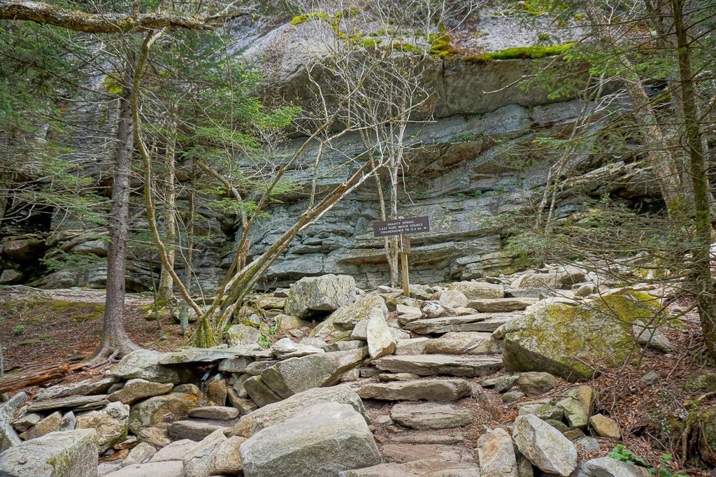
Despite being over 30 years old, the trail up to this point has been in good condition, without too much erosion, drop-offs, haphazardly strewn rocks, or undercut roots - having been purpose-built by experts.
Until 2021, things changed drastically past Shanty Spring. All of those ankle-twisting features became common as the "trail" was simply the shortest historical route to the spring from the summit - which means it went directly down the slope. It was like climbing straight up the mountain on a pile of boulders, stones, and bedrock, intermixed with hanging roots, through a very wet spruce-fir forest.
However, as of 2021, a major trail reconstruction project has turned the last 3/10 mile from Shanty Spring to the summit ridge into a near-continuous set of beautifully arranged stone steps! Though these were placed by trail machines rather than strictly by hand, they're almost as aesthetically pleasing as the earlier sections (or will be once the rain washes a bit of the mud off) and designed to shed water at every opportunity.
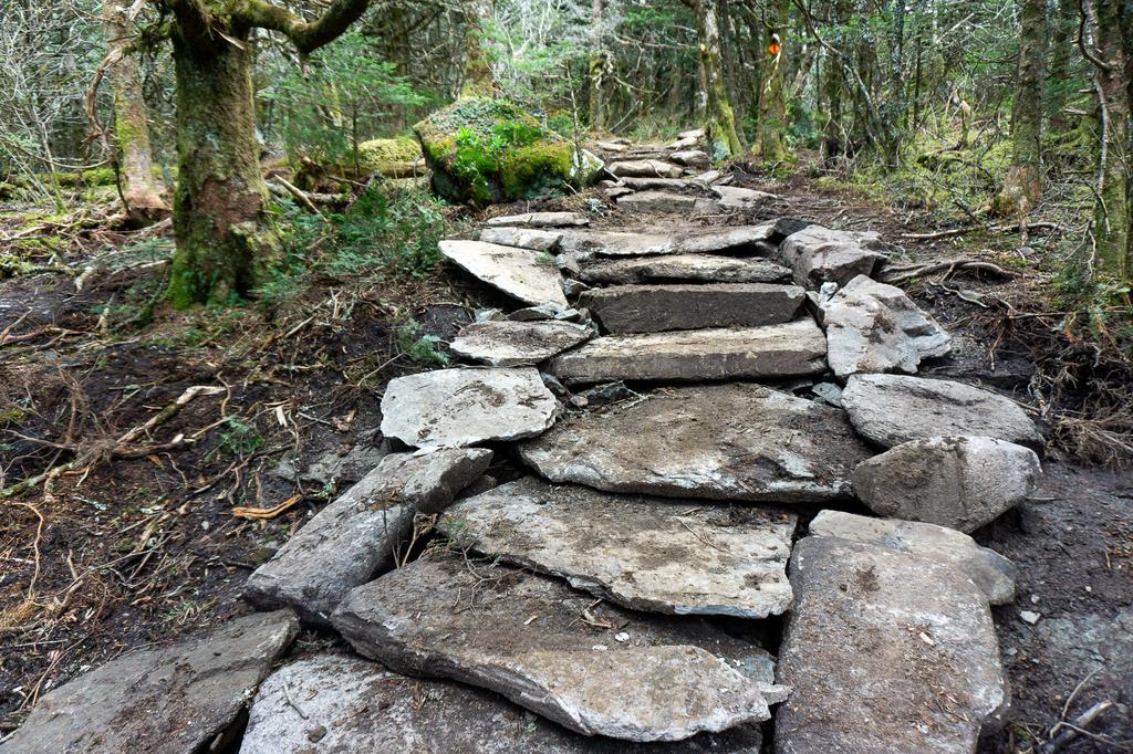
Use of trail machinery allowed this upper portion of the trail to be rehabbed in a matter of months as opposed to the years it would've taken using only hand tools. Though it is still steep, the climb is nothing compared to what it once was. A few very short sections were deep mud as of May 2021, but this should settle down as the summer warmth dries things out and the soil disturbance caused by construction is finished up. This is another stretch of this trail that should last a very long time with minimal maintenance!
The Profile trail evens out and crosses the summit ridge at about 5675 ft. elevation in a little section of nondescript Fraser Fir forest, and descends just a few yards to its unceremonious end at the Grandfather trail. A good set of directional signs marks the spot, like most intersections in the park. To continue the hike up to Calloway Peak, turn left onto the Grandfather trail, which starts back uphill along the ridgeline through the spruce-fir forest and a few small openings filled with smooth blackberries.
Though not as rugged as the peaks farther south, the trail does pass over some narrow, rocky sections of the ridge. So take your time when you get to them and enjoy the views which become more open as you go. There are no major intersections along this last stretch, but a side path to the right leads to a campsite with a sunrise view, and one to the left leads 100 ft. to Watauga View, which is a great northwest facing rock outcrop - although a substantial part of that view is comprised of roads, luxury homes, golf courses, and shopping centers, covering both the valleys and even the mountaintops.
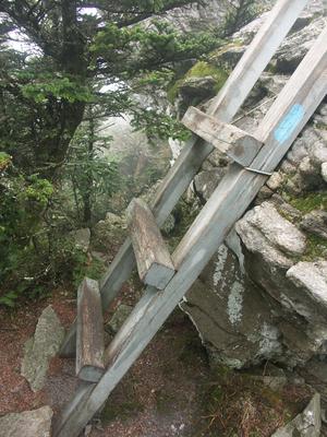
The Grandfather trail you are on is one of the oldest trails on the mountain, and travels along the summit ridge all the way from the Attraction area to the top of Calloway Peak. Unfortunately, it is deeply eroded and entrenched into a gully for several stretches. To negotiate some of the steeper rock outcroppings, the park has incorporated some big sturdy ladders made out of 4x4 posts into the path. This makes the climbs relatively easy, but not without some sure-footedness and risk.
The bigger ladders are further south along the Grandfather trail on MacRae and Attic Window Peaks; you'll encounter only a few smaller ladders on the 0.4 mile stretch up to Calloway Peak on this hike. Pets may have trouble here, although my dog learned to climb the ladders herself with a little coaxing!
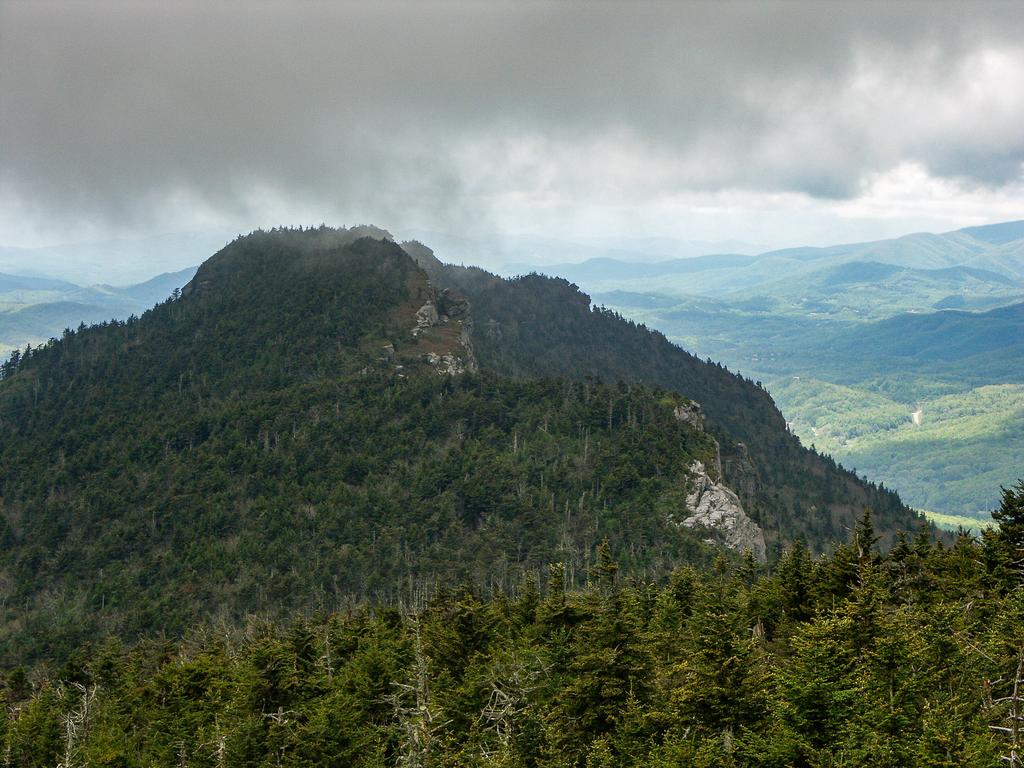
Finally, the ridgeline starts to level out and you'll see the summit of Calloway Peak up to your right. A nice outcropping on the left makes a good preview stopping point just before the summit, with more of a western view. (It also makes a good overflow area for hanging out or even a turnaround if the true summit is full or overflowing).
The trail wraps around the rocks just below the true summit and then climbs up onto them, making a sharp right turn. The peak is marked by some blue blazes spray painted on the rocks for the Grandfather and Daniel Boone Scout trails, which both end here at 5964 ft elevation. There is a sweeping, cliff-top view across the tops of the evergreen trees to the south and east. Thankfully, less development can be seen from here than back at Watauga View. You'll see the Blue Ridge Parkway, part of the Linn Cove Viaduct, the Blue Ridge escarpment dropping away below that, MacRae and Attic Window Peaks back down the ridgeline, and of course the Blue Ridge mountains stretching in all directions.
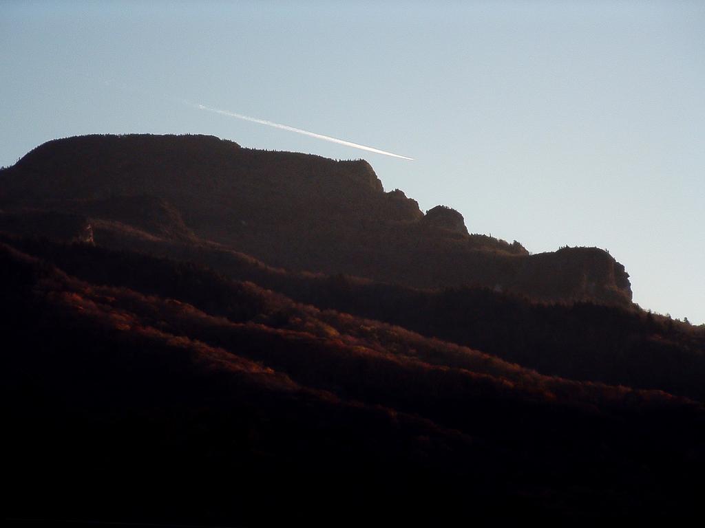
When you're finished soaking up the scenery, return to your vehicle on the same path to complete the hike.

