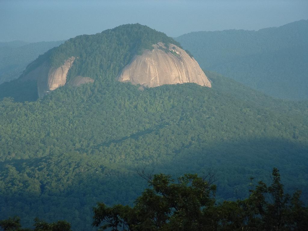
Looking Glass Rock
At A Glance
TODO: #32 Boilerplate

6.4 mi round-trip
Difficulty Rating: 10.39 ![]()
Climb: Climbs Steeply ![]()
Tread Condition: Moderately Rough ![]()
Highest Elevation: 3969 ft
Climb Total: 1649 ft
Configuration: Out-and-back
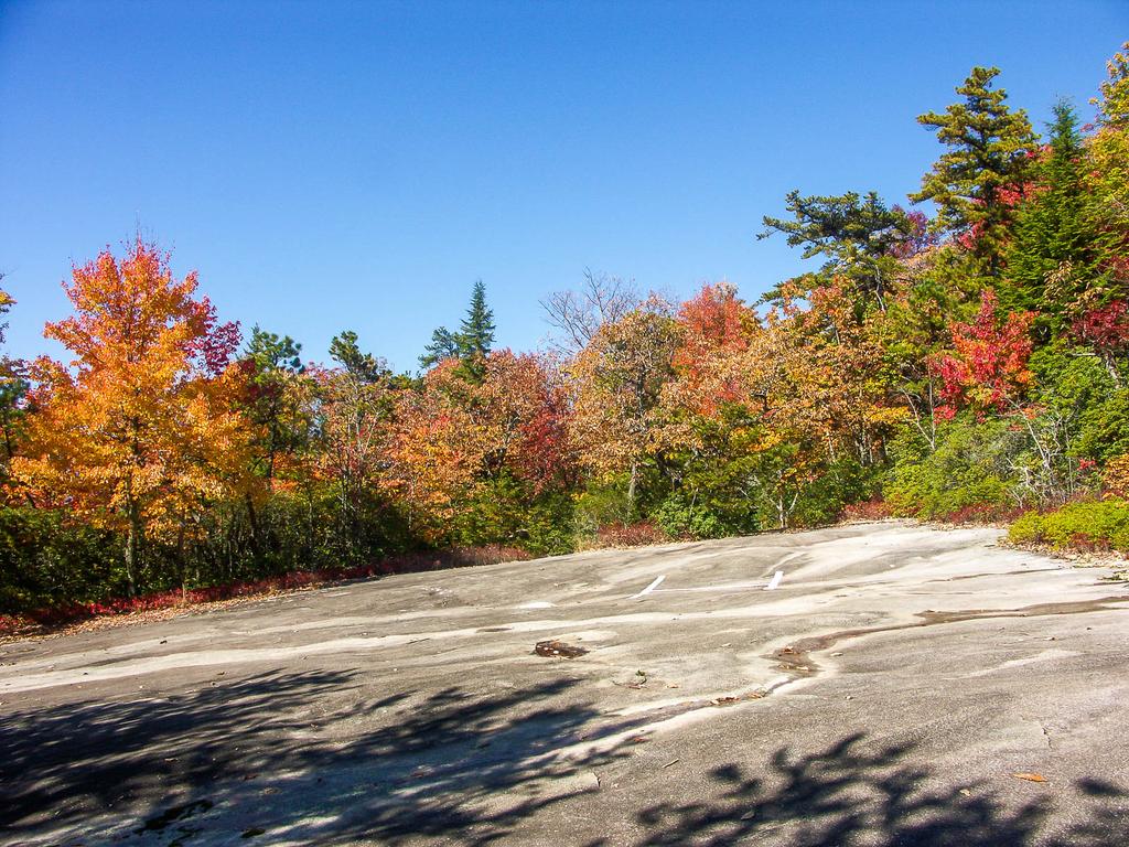
Starting Point: Parking Area on FR 475
Trails Used: TODO dynamic list Looking Glass Rock
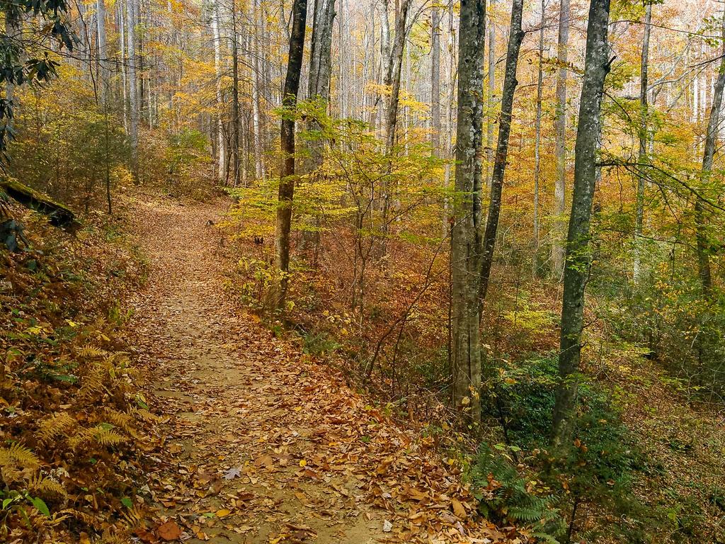
Begin the hike on the signed Looking Glass Rock trail at the back of the parking lot, which begins with some steps. There is only one trail, which leads all the way to the top.
The trail enters an open forest once consisting of mostly hemlock trees. These are now dead, so other species are beginning to grow and take up their space. The dead trunks still stand, so until they are completely down, watch for falling limbs, especially on windy days.
This hike isn't really known for being a water hike, but it starts by going uphill in a cove beside a small stream. This stream drains the left side of the small ridge you'll generally follow all the way up to the summit of the mountain. It runs crystal clear - when it's not dried up! The trail swings right to cross the creek on a footbridge, then ascends the ridge on the opposite side.
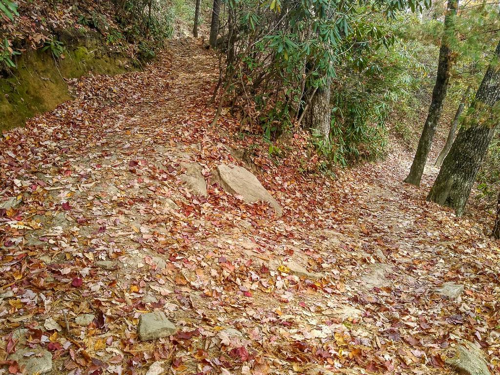
On this lowest section of the hike, the trail does climb, but only moderately so, and the surface is in generally good condition. You'll come around the ridge, and climb into the cove on the other side, where a larger stream flows. There are actually some nice yet small cascades on this creek during high water. Climbing upstream, the trail is high above the water on a narrow bench on the hillside. At times, it dips into side coves where it crosses some small wet-weather seeps, but no real tributaries.
Soon the trail hits the first of the many switchbacks you will encounter on your way up, and at this point the woods are thin and open. You'll be able to see the trail both below and above you as you begin winding in and out of small side coves. There are so many switchbacks that the trail never really becomes extremely steep.
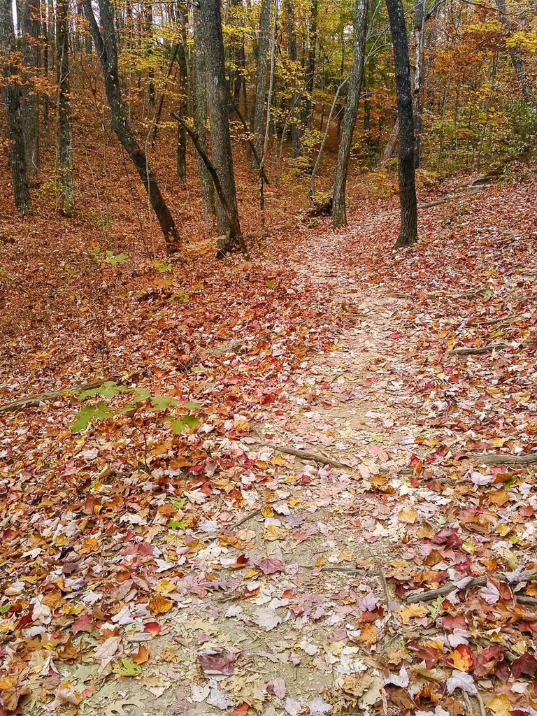
As you climb, the switchbacks become tighter and more frequent and generally stick to the face of the small ridge. The forest transitions into more of a mesic one, and the trees higher up are a bit shorter than down below.
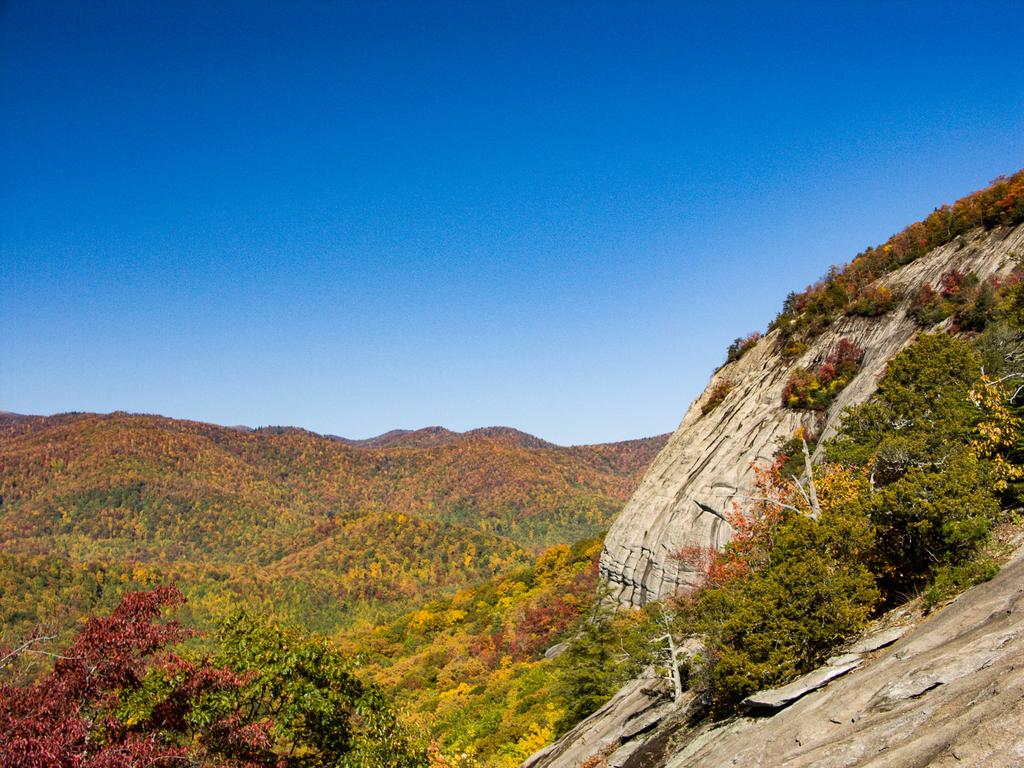
About 1/3 of the way to the top of the mountain, you'll reach a left-hand switchback with a large Carolina hemlock anchoring the tip of it. Just past the hemlock is a 30 ft sheer drop-off. You have a limited view from here of the cliffs on the north side of the mountain. Below you, during wet weather, a small trickle of water chuckles over the rocks, almost forming a waterfall. It goes without saying to be careful here if you explore near the hemlock.
At this point, you're starting to ascend a steep band of rocks which just about completely surround the mountain. The mountain is a ridge, shaped kind of like whale surfacing from a sea of trees around it, with the part you're climbing being near the tail. The nose would be where the highest cliffs are located - and where you'll end up for the final view.
The slope is not quite as steep back on this side, which is why trees can grow on it and why the trail was built over here; on the mountain's other aspects, this cliff band are pretty much vertical and treeless. You can't see much along this section, except for some limited views in winter.
For the next few switchbacks, you'll be ascending this steeper part of the slope. The forest around the steep area consist largely of Carolina hemlocks. This is a relatively rare tree which thrives in the thin soils and high exposure areas of North Carolina's rocky mountainsides. In fact, this tree is only found in southwestern Virginia, eastern Tennessee, western North Carolina, and very small areas of upstate South Carolina and Georgia.
The trail curves into a small cove carved into the top of the ridge, with a gulch at the bottom that is dry most of the time. You'll pass a nice, large campsite on your left, then swing left and ascend the side of the cove. You're approaching the halfway point of the hike right about here, and the trail is becoming steeper and rougher as it starts ascending along the spine of the ridge.
Almost everywhere you go in the Southern Appalachian mountains, you find rhododendron and mountain laurel shrubs. There is no lack of those here either; they really become noticeable as you get higher up on the ridge. The trail slips off to the left side of the main ridge line and then you will cross a small, wet-weather tributary. When it runs, it must plunge over a waterfall at some point downstream considering that you're above the cliff band at this point. If there is water here - which there seldom is - enjoy it because there is no more along the rest of the trail.
Beyond the tributary - or damp spot - you'll swing back and forth through switchbacks as you start to pass and cross over some of the large rock slabs which characterize the top of this mountain. After a sharp left hand turn, you'll pass a flat rock slab on your left which is used as a helicopter pad, and is marked with a big "H" painted on it. And at the edge of the helipad, carved deeply into the rock, is the following text:
MAX WILSON
3-9-30
10-30-55
Mike Bailey kindly sent us the following comment on the origin of this text:
"Max" was from Asheville, NC, and was a former US Marshal (among other things). He was bigger than life and a wonderful, generous man. My brother-in-law was with Max when he "chiseled" his initials and dates into the flat granite there at the heli-pad location. Max told me on a hike up there in 1965 that he wanted to carve more "but he ran out of beer."
For this reason, you'll sometimes hear people refer to this as Max Wilson Rock.
The final push to the top of the mountain beyond the helipad is somewhat steep and eroded, so watch your footing. The actual summit itself is somewhat unimpressive - it's round and almost flat, covered by oak, mountain laurel, and rhododendron. It doesn't even quite reach 4000' in elevation (at only 3969' above sea level), so there's kind of a letdown in that, too. But there is a nice campsite on the left, just before the top. The trail will actually start downhill again before it emerges from the forest atop the major cliffs on the west-northwest face of the mountain.
The Carolina Hemlock really looks like it belongs here. You can distinguish it from the more common Eastern Hemlock by the stiffer needles which emerge from the stem at all angles, rather than in a flat plane. Its seeds are the longest of any of the native hemlocks. Adapted to the harsher conditions in which it grows, it has stiffer twigs than the Eastern Hemlock. And it has an overall shape more similar to alpine species including spruces and firs which live at higher elevations and farther north.
A few of them have fallen due to high winds in recent years. And sadly, the Hemlock Woolly Adelgid infestation is well underway here and has taken a few more, and threatens to kill the rest of them without intervention. But many of the trees on Looking Glass have been treated with insecticides and adelgid-eating predator beetles may also be in the area. As of fall 2016, many of the Carolina hemlocks on Looking Glass remain healthy and green. Let's hope they can stay that way!
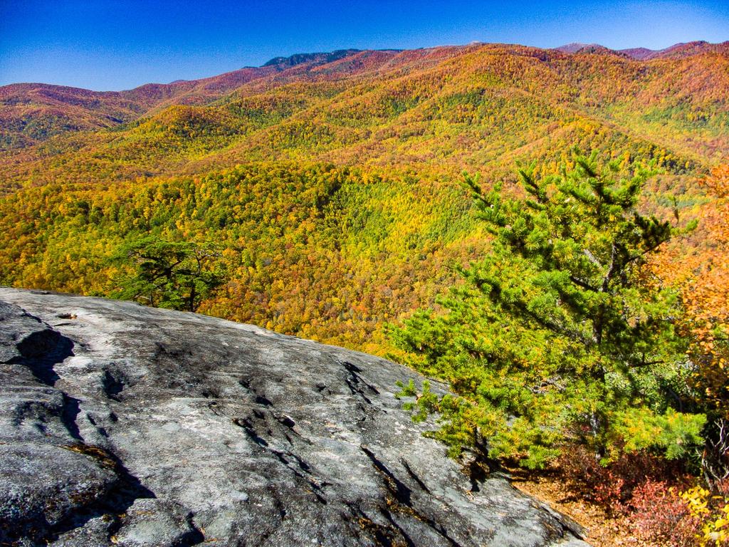

Once you pop out on the cliffs, you'll immediately see why this hike is so popular. The view is, of course, wonderful. Be careful and stay on the flatter rock at the edge of the forest, which isn't too risky if it's dry. Be especially wary if you have kids or dogs with you - it is a long way down once you go over the edge.
You'll be looking out toward the Pisgah Ridge and can see the Blue Ridge Parkway and Black Balsam Mountain looming above you. At your feet, small gullies have been carved into the rock by water seeping out of the mat of roots, soil, rocks, and forest duff that forms a thin cap on top of the mountain. Watch out for patches of water, algae, pine needles, or ice on the rock that could send you sliding as you search for that perfect spot for a photograph!
When you are finished soaking up the view, return to your vehicle via the same trail.

This site is part of the
WNCOutdoors.info network
Western North Carolina
Hiking | Mountain Biking | Waterfalls
Advertising Information | Contact Us
©1996-2025 CC-BY-SA | Privacy Policy