John Rock Loop
At A Glance
TODO: #32 Boilerplate

5 mi round-trip
Difficulty Rating: 7.59 ![]()
Climb: Climbs Steeply ![]()
Tread Condition: Moderately Rough ![]()
Highest Elevation: 3320 ft
Climb Total: 1000 ft
Configuration: Loop
Starting Point: Parking Area at the Pisgah Center for Wildlife Education (Fish Hatchery)
Trails Used: TODO dynamic list Cat Gap Loop, Cat Gap Bypass, John Rock

Begin the hike by following Forest Service Road 475C out of the parking lot. It's to the left as you face the main building. Go around the gate and immediately cross a stinky creosote-soaked log bridge. Immediately past the bridge, turn right onto the Cat Gap Loop trail.
This trail will get your blood pumping from the start, with a climb up some log steps, but it soon levels out to a gently rolling grade. It lies just outside of a forest demonstration area delineated by a green chain-link fence on your right. Look inside the fence to see the last remaining healthy hemlock trees in the area (they've been treated with insecticide; many of the rest on this hike are dead). The trail will cross one small tributary, which you could formerly rock-hop easily without getting wet (but has been getting wider and muddier over the years).
The forest here has many different varieties of trees: cove hardwoods (namely tuliptree and oak), white pine, shortleaf pine, (formerly) hemlock, and more. In places there is an extensive ground cover of Lycopodium - also called "ground pine" and "running cedar". Ground pines are some of the oldest varieties of plants in existence, and they used to dominate the landscape with tree-sized forms. Now diminutive, this cute little plant looks like a 6 inch high forest of its own! The spores of this plant are very flammable, and were once used to make flash bulbs for photography.

You'll come to a footbridge over Cedar Rock Creek; cross it, cross the gravel road just after it, and pick up the Cat Gap trail again on the other side. A short, moderately steep climb takes you up to an old roadbed. From here, the trail becomes a wide, eroded path that gradually gains elevation up along the side of the valley.
You will pass the weir where the water is diverted into the fish hatchery, far down below you on the left. The cold, clear waters of Cedar Rock Creek are perfect for raising the trout in the hatchery.
At times, rhododendrons arch over the trail forming a "tunnel". You'll pull away from the main valley and head up a side cove, then cross a very low ridge. Soon you'll start to hear (and see, now that the hemlocks are dead) Cedar Rock Falls on your left. The trail will pass a nice but overused campsite with a small cascade beside it; the main falls are just downstream.
(To get to the base of the main falls, follow the path downhill from the campsite. Bear left where the path drops over a small ledge to find a less risky route around and down. It's worth a visit but be very careful around waterfalls and slick rocks. There are high drop-offs in this area.)
Continuing on the Cat Gap Loop trail past the campsite, you'll reach the intersection with the Butter Gap trail, at a big rock slab in a grove of surviving (as of early 2019) Eastern Hemlock trees. This hike goes left across the bridge, remaining on the Cat Gap Loop, but you may wish to explore to the right a bit, which is a relatively open area known as Picklesimer Fields. It reminds me of a mini version of the nearby Pink Beds area, with slow, meandering streams winding through shrubby and open areas.
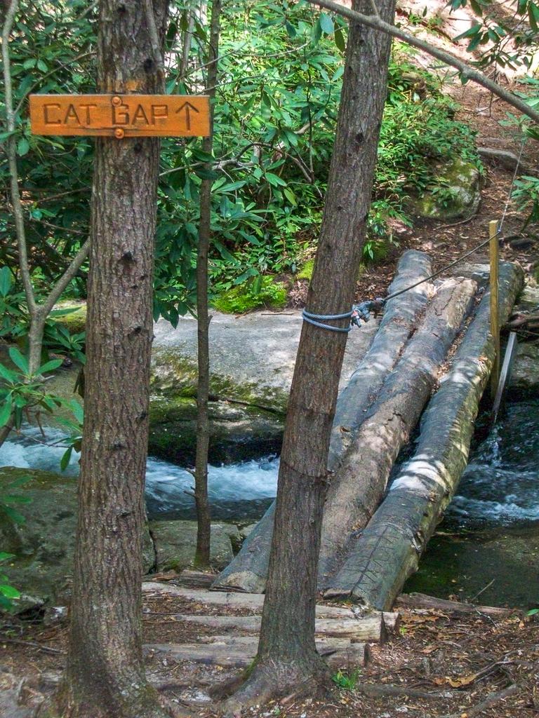
Back at the rock slab, Cat Gap Loop goes left across a log bridge with a cable handrail, at the point where the lazy stream starts to drop out of the level valley bottom and over the falls. You'll then begin heading upstream through the southern arm of the valley along Cedar Rock Creek. I saw a rattlesnake not far off the trail here in May 2013 - this is definitely the type of area they like to hang out, so keep that in mind.
The trail crosses the creek again on another log bridge and comes out in a planted stand of white pines where there is almost no undergrowth. This makes a popular campsite. The trail continues to the left, upstream.
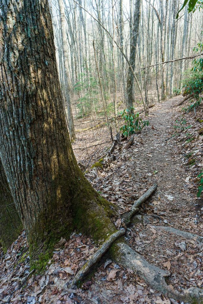
The trail will cross the creek again. This time, it's a rock-hop, but this crossing has been widening over the years and is now a muddy mess. Past the crossing, the trail becomes significantly steeper. It angles to the left (east) up the mountainside and works its way up onto the nose of a ridge on a very eroded section of path. The trail ascends the unnamed ridge via a few switchbacks. Footing is generally good, though there is still some erosion, and a there are a few rooty and rocky sections.
The trees become older, and you'll be traveling through a mixed hardwood forest typical of these sloped areas at this elevation. The thick understory of mountain laurel and rhododendron would make traveling off-trail here extremely difficult. It also poses somewhat of a fire hazard. Since the era of fire suppression, undergrowth like this has become much more common. The Forest Service sometimes use controlled burns to reduce fuel loads and open up areas such as this. Nature uses wildfires to do the same thing, but in a much more dramatic, uncontrolled fashion.
As the climb begins to de-intensify, you'll reach the intersection with the Cat Gap Bypass trail. Turn left here onto the Cat Gap Bypass. (Straight ahead, the Cat Gap trail climbs to reach the Art Loeb Trail northeast of Cedar Rock Mountain, in Cat Gap).
Cat Gap Bypass traverses a high slope below Cat Gap, at the head of John Rock Branch at about the 3100 ft elevation mark. It provides a much easier, shorter, and faster way to reach the John Rock trail than going up and down through Cat Gap. You'll pass through varied forest environments in rapid succession. As you go out around ridges, look for mostly oak trees. When you dip into the small coves you'll find tuliptree and (formerly) hemlocks. In the wintertime you can catch views of the side of John Rock through the branches.
You'll come to a four-way intersection in a deep gap to the south of John Rock. Turn left here onto the John Rock trail. (To the right is the other end of the Cat Gap Loop trail as it comes back down from Cat Gap and the Art Loeb trail. Straight ahead is also the Cat Gap Loop, which promptly descends into Horse Cove).
The John Rock trail begins a steep climb up to an unnamed knob along the ridge leading out to John Rock. It could afford some switchbacks, or even to skirt around this knob entirely. But for now, watch your footing as the trail is rocky and deeply eroded with roots crossing the trail, suspended a foot or more in mid-air in places. One portion is a steep climb up a jumbled rock pile. Fortunately, the rough section of trail is short-lived.
After reaching the top of the knob, you'll start gradually down again toward John Rock. This is the highest point on the hike, at approximately 3320 ft in elevation. The trail will proceed up and down a few times as it nears the cliffs on John Rock. You'll reach a T-intersection; the yellow-blazed John Rock trail turns right. But continue straight ahead to reach the overlook. The trees become smaller and disappear right before you pop out onto the face of John Rock.
This goes without saying, but: be extremely careful here! It's a 200 ft sheer drop to the rocks below. It's not unsafe to enjoy the view from the edge of the forest if the rock is dry, but watch out for wet rocks and slippery things like leaves, pine needles, moss, and algae which could send you sliding downhill!

Enjoy the view north across the valley of Looking Glass Rock and of the Fish Hatchery below. Bring a pair of binoculars and see if you can pick out your car in the parking lot! To your left (northwest) is the Pisgah Ledge and all the ridges extending off from it. Just to the right of Looking Glass Rock (northeast) is Coontree Mountain, and to the right of that is Bearpen Mountain.
After you're done soaking up the views, head northeast along the edge of the woods to the right, and pick up the trail again heading downhill. This is the continuation of the loop, and it heads in a generally southeastern direction.
You'll pass through a large, gently sloping area to the east of John Rock, where the trail winds around a bit. Then it drops downhill slightly into a cove filled with a dense undergrowth of rhododendron and mountain laurel.

From this cove, the trail begins winding back uphill again slightly, over into the next cove, where it starts to descend in earnest. You'll bottom out at a crossing of Horse Cove Creek on a sketchy log bridge; on the other side you'll reach the eastern intersection with the Cat Gap Loop trail. Turn left, downhill.
The lush forest in this area is dominated by tall, straight tuliptrees, one of the most common Cove Hardwood species. Dark, lacy hemlocks used to grow in the shade of the tuliptrees here, waiting paitently for a chance to dominate the canopy some decades into the future, but unfortunately, they are narly all dead now. This cove sports a spectactular spring wildflower display.
You'll reach an intersection with FS road 475C; go straight across and continue on the Cat Gap Loop trail downhill to another stream crossing. This time, it's a rock-hop.

Horse Cove starts leveling out near its confluence with East Horse Cove; then the trail will pass out of the mouth of the cove and begin heading upstream beside the flat, gently flowing Davidson River.
Although you are climbing gain very slightly on this section of trail, you'll hardly notice it compared to the rest of this hike. This section of trail is on the north side of John Rock; the area is wet and several small tributary streams and seeps pass beneath the trail to join the river. Rhododendron and doghobble grow thickly in places.
Once dominated by cool, dark hemlock trees, this section of forest is returning to a place of cove hardwoods, with just a few scattered mature hemlock remaining alive as of early 2019.
Near the end of the hike, a large, once-attractive campsite opens up to your right. (Dying and falling hemlocks will make this on a bit less than ideal for a while). It's also a great spot to relax by the river at the end of a great hike.
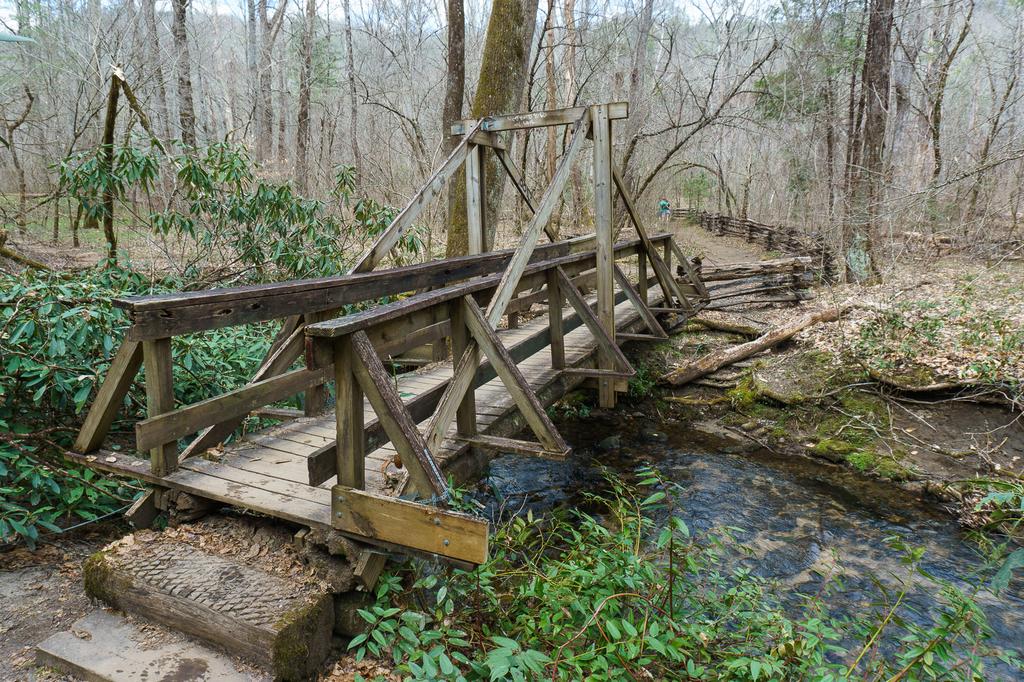
Finish the hike by crossing the last unique triangle-beam bridge over Cedar Rock Creek. In just a short distance further, you'll come out of the forest at the eastern end of the Pisgah Center for Wildlife Education parking lot.

This site is part of the
WNCOutdoors.info network
Western North Carolina
Hiking | Mountain Biking | Waterfalls
Advertising Information | Contact Us
©1996-2025 CC-BY-SA | Privacy Policy